I. SUMMARY INFORMATION
Project
267501
Status
Submitted
Award category
Regenerated urban and rural spaces
You want to submit
NEW EUROPEAN BAUHAUS RISING STARS : concepts or ideas submitted by young talents (aged 30 or less)
Project title
Porto di Mare Eco-District (Milan)
Full concept/idea title
Porto di Mare Eco-District: multi-layered modelling and Food District&Transportation Hub design
Description
Is it possible to combine economic, social and environmental aspects in a sustainable urban regeneration process? How can algorithms and modelling strategies match and satisfy community needs? Porto di Mare Eco-District project combines a multi-scale design, focused on a bottom-up holistic approach, acting on people and transforming users into more sensible agents. The outcome is a replicable approach for similar urban rural contexts, to be used at 360-degrees.
Where is your concept/idea being developed or intended to be implemented in the EU?
Italy
Lombardy
Via Fabio Massimo, 15
milan
20139
II. DESCRIPTION OF THE PROJECT
Please provide a summary of your concept/ idea
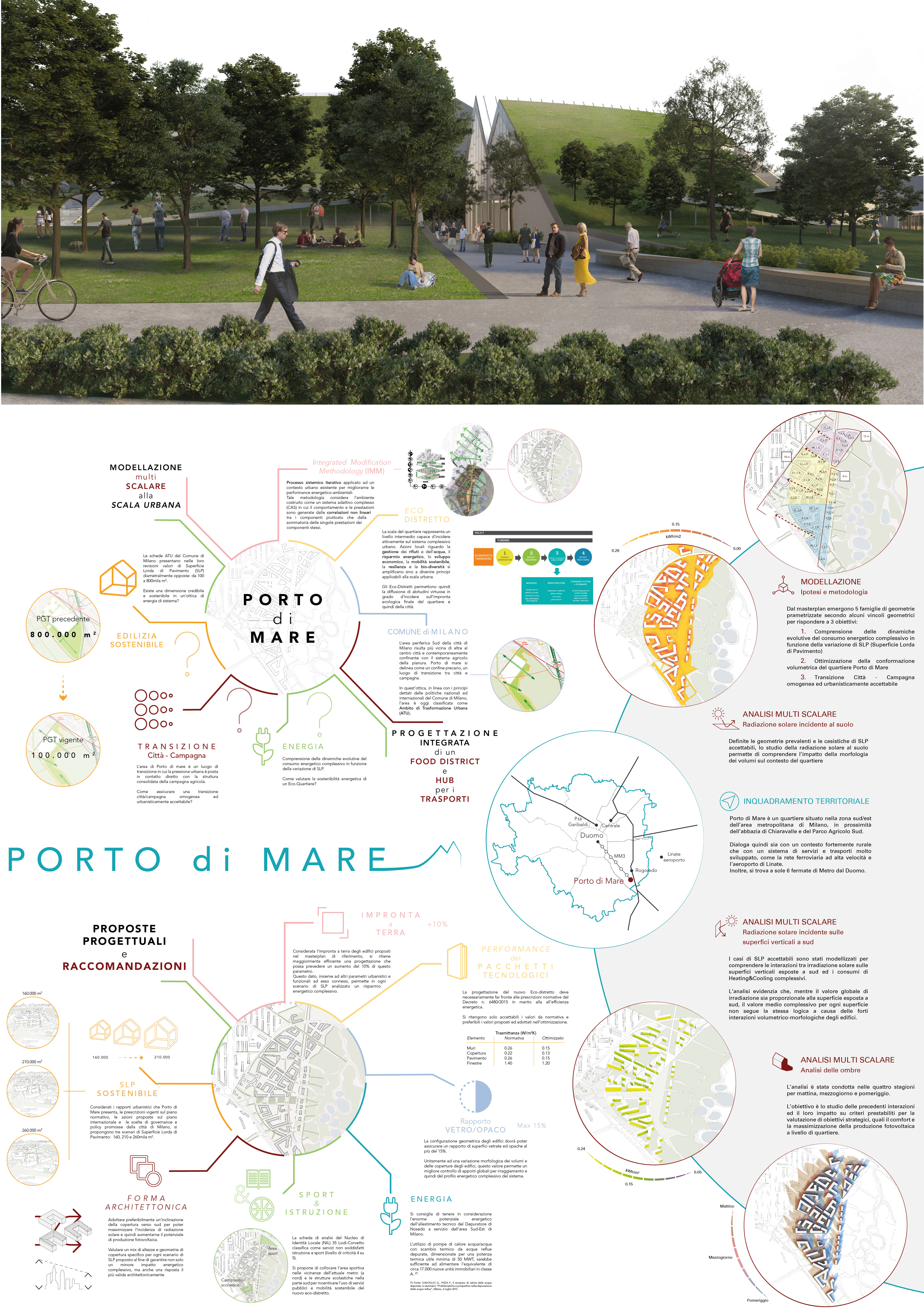
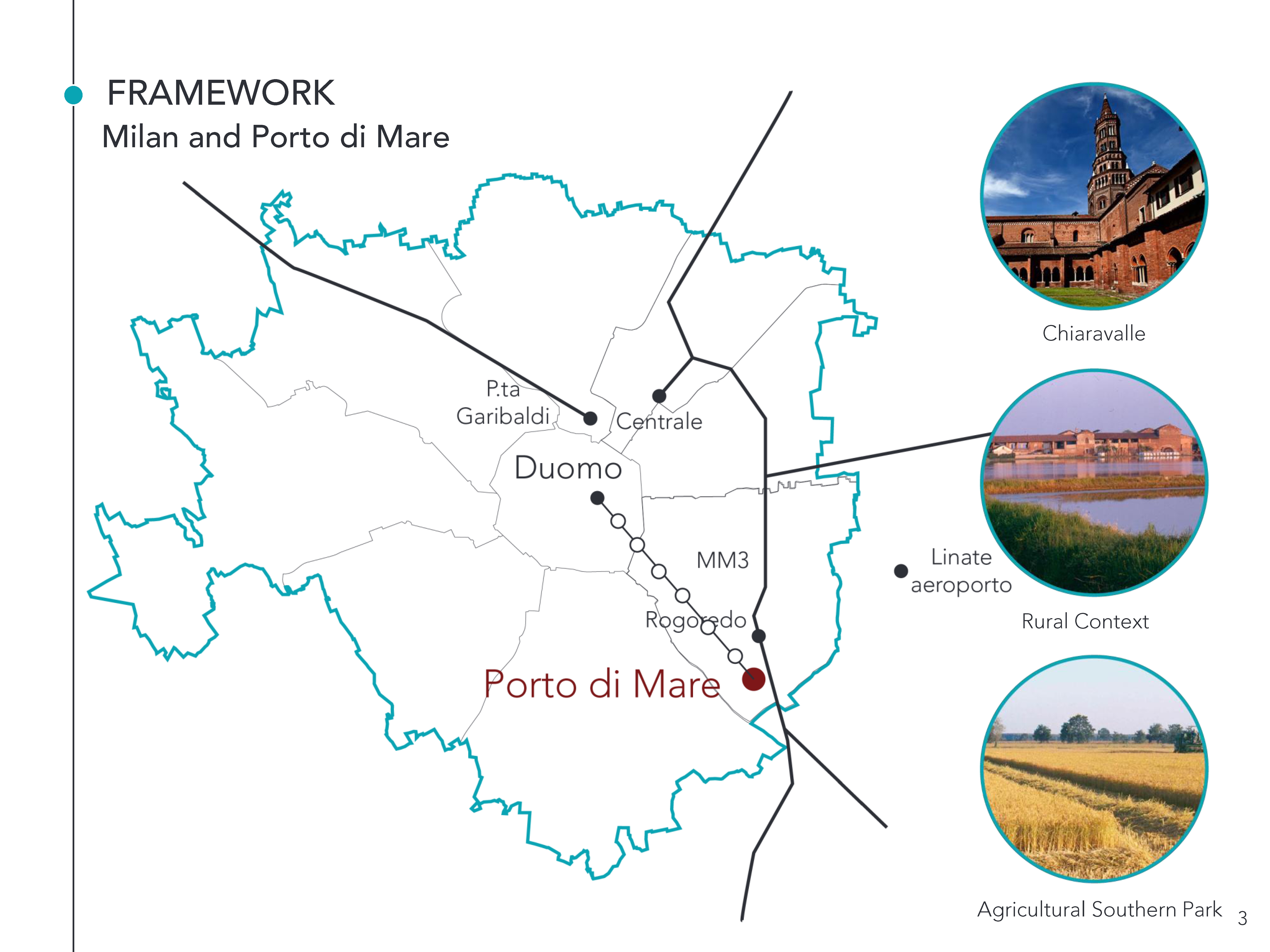
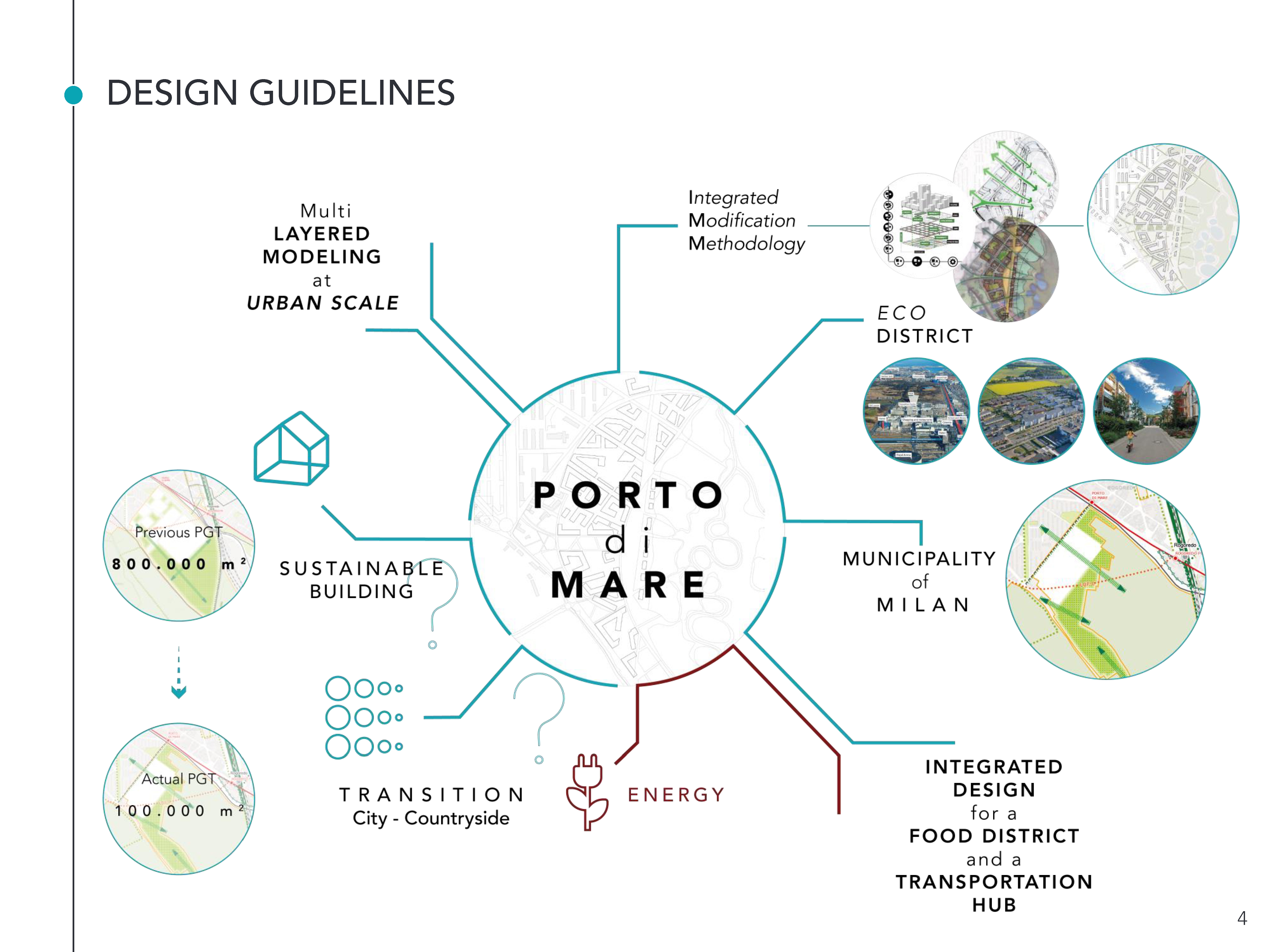
The study case area of Porto di Mare is located on the south-eastern border of Milan, bounded by important infrastructures, between the city center and the rural belt surrounding the city. The key objective of the project is to reconnect the metropolitan area with the adjoining countryside, through the creation of a district planned at a human scale. Here the community can live in a “15 minutes” format, which means having almost all the possible services (public transports, jobs, food, recreation, green spaces, etc.) at a 15-minute walking distance.
The proposal of an Eco-District is an opportunity to demonstrate the potential implications of a sustainable regeneration process on territorial low-carbon energy planning strategies, with a significant impact on a larger part of the city. On the one hand, there is the need to limit soil consumption and urbanization rates, whereas on the other hand, the presence of slums and brownfields within formal urban contexts compromises the living conditions in the neighboring areas.
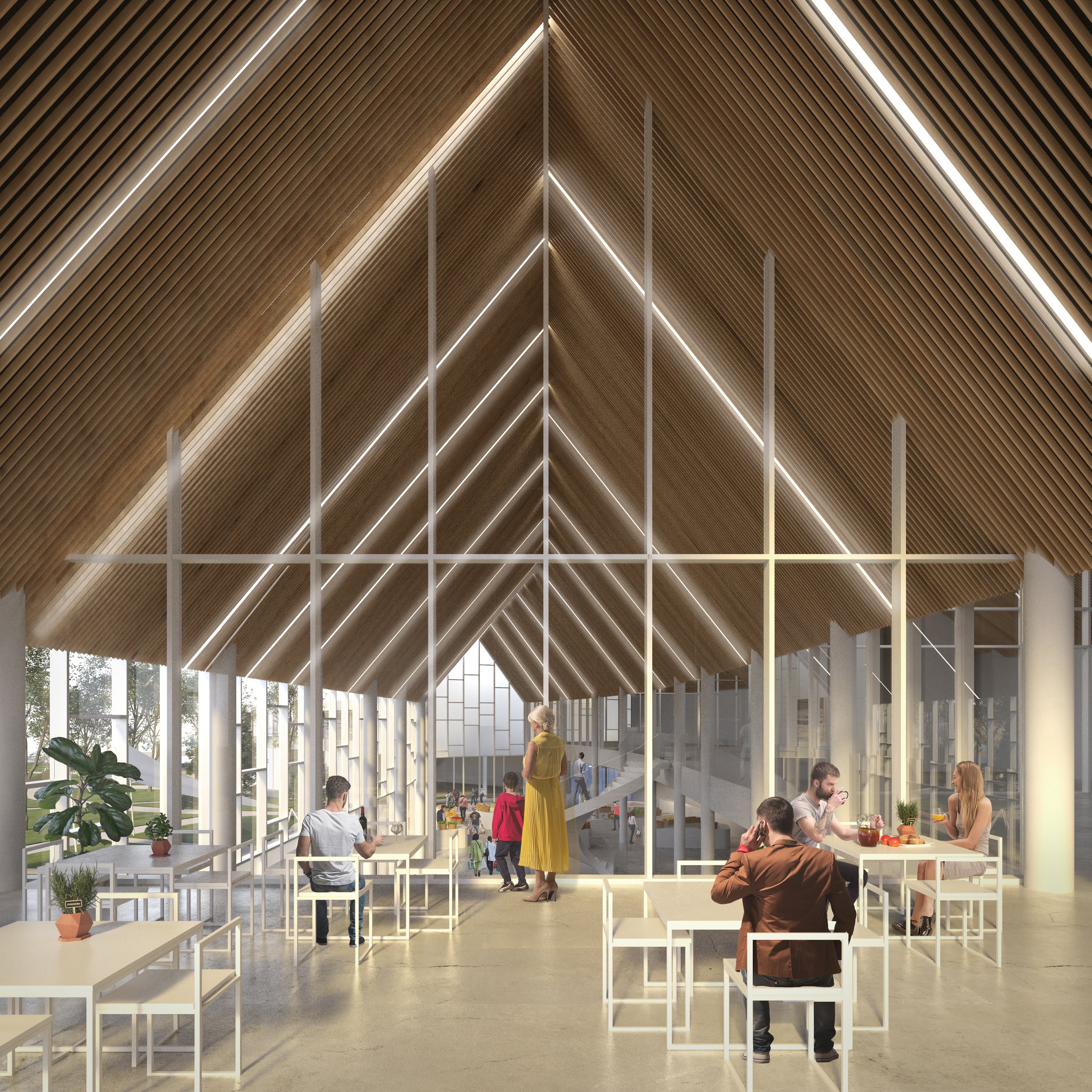
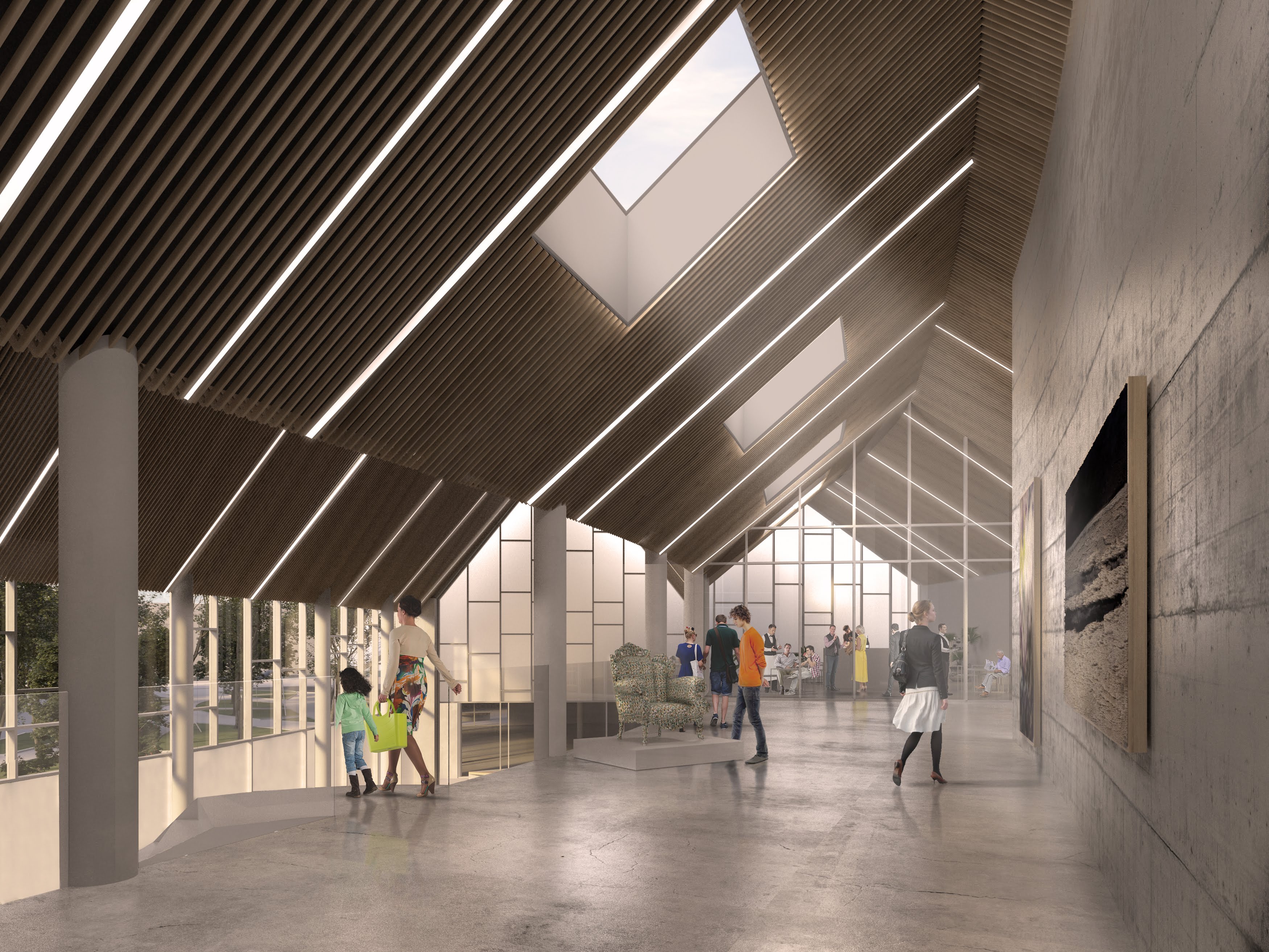
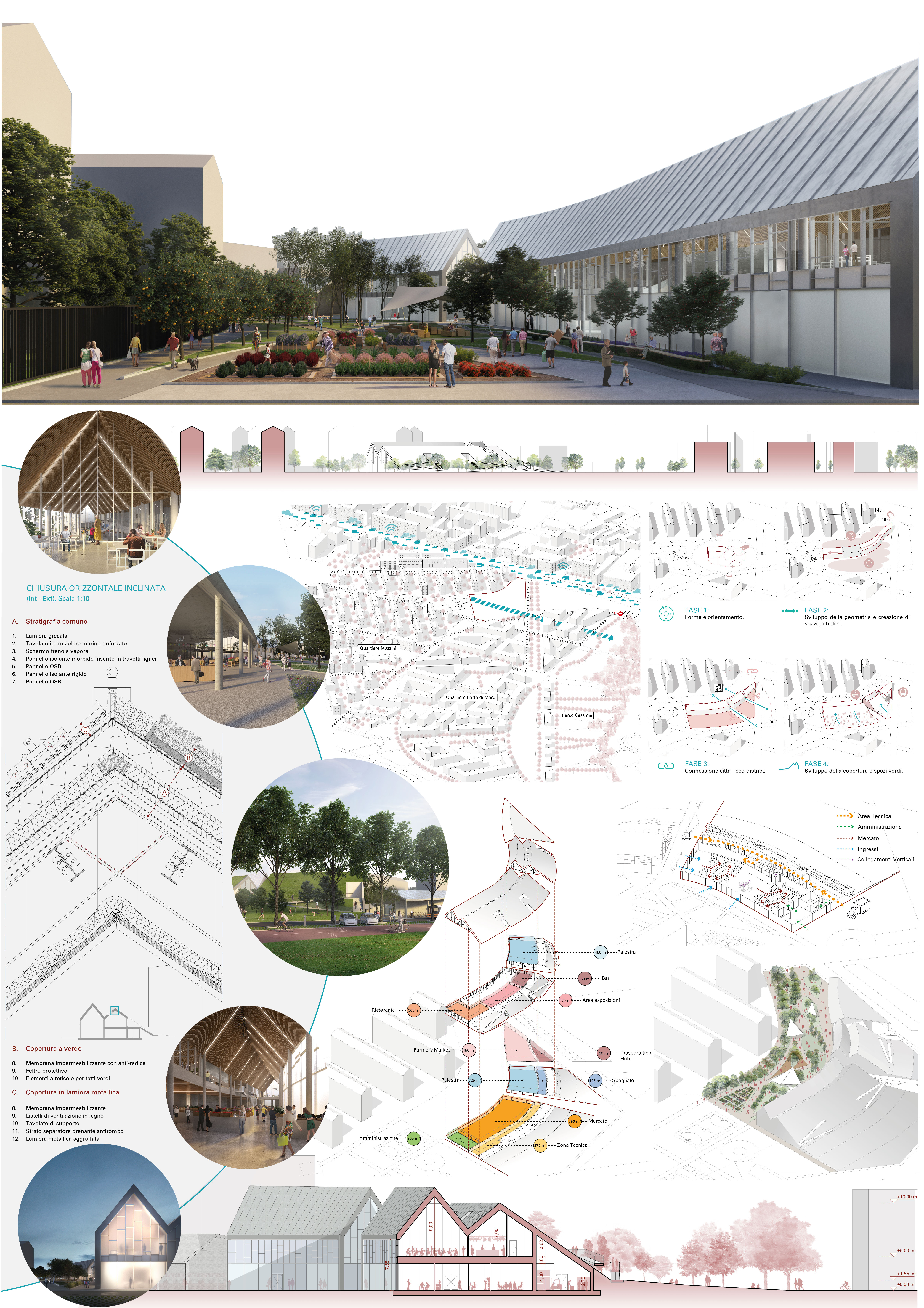
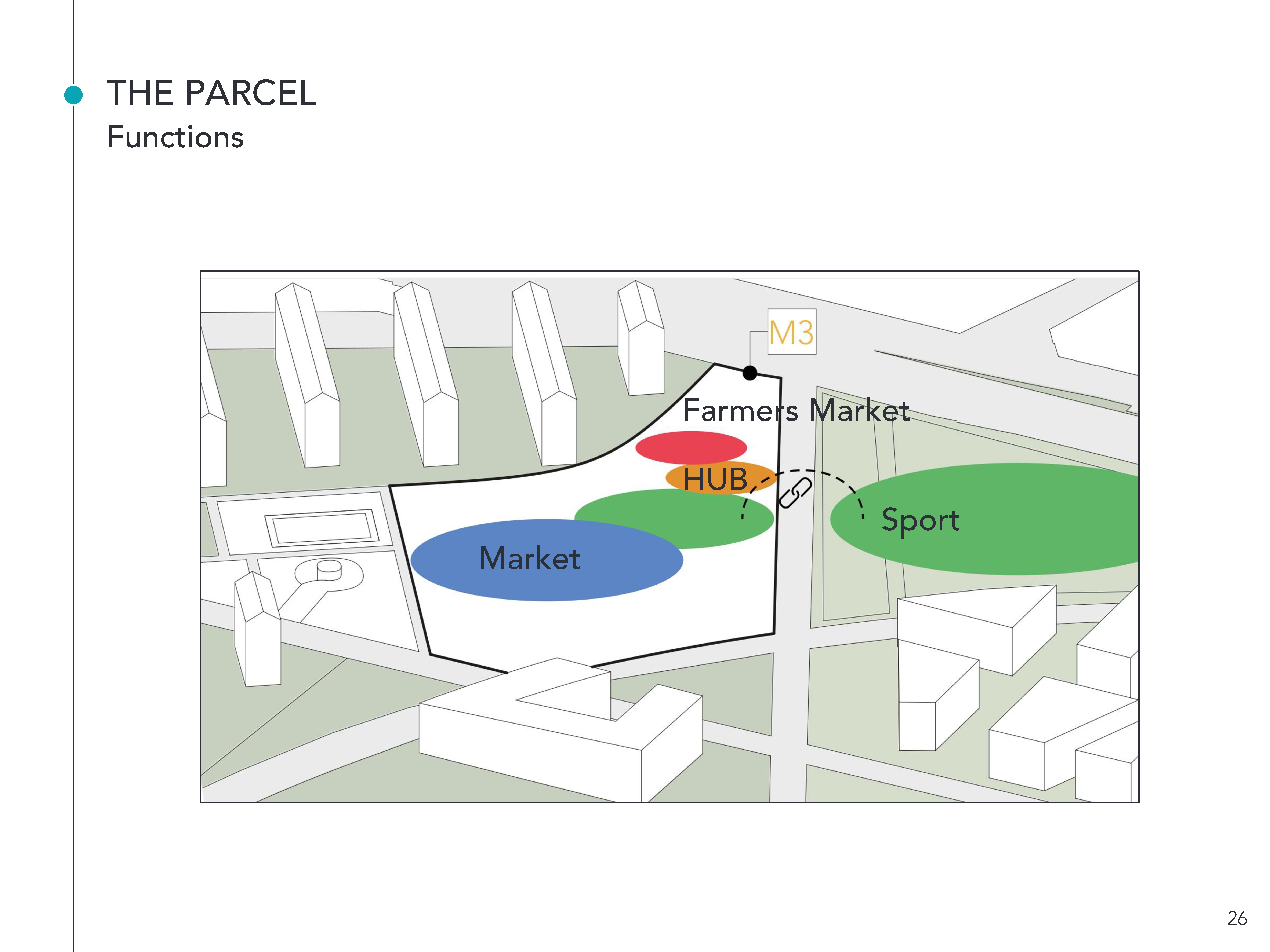
Given the complexity of the topic, a holistic, multi-scale and multi-disciplinary approach is required. Through Integrated Modification Methodology (IMM) and parametric BIM tools analysis of the area, different strategies have been identified for both the district as a whole and the singular building that composes it. Once the main common strategies were identified, the project focuses on the Food District and Transportation Hub, the modern piazza where people from both inside and outside of the neighborhood can meet and exchange food, knowledge and cultures.
Please give information about the key objectives of your concept/idea in terms of sustainability and how these would be met
Porto di Mare aims to become a self-sufficient Eco-District where residents can easily find all the commodities, from groceries, to schools, to sport facilities, to the metro station which connects directly to the city center, without having to use a car.
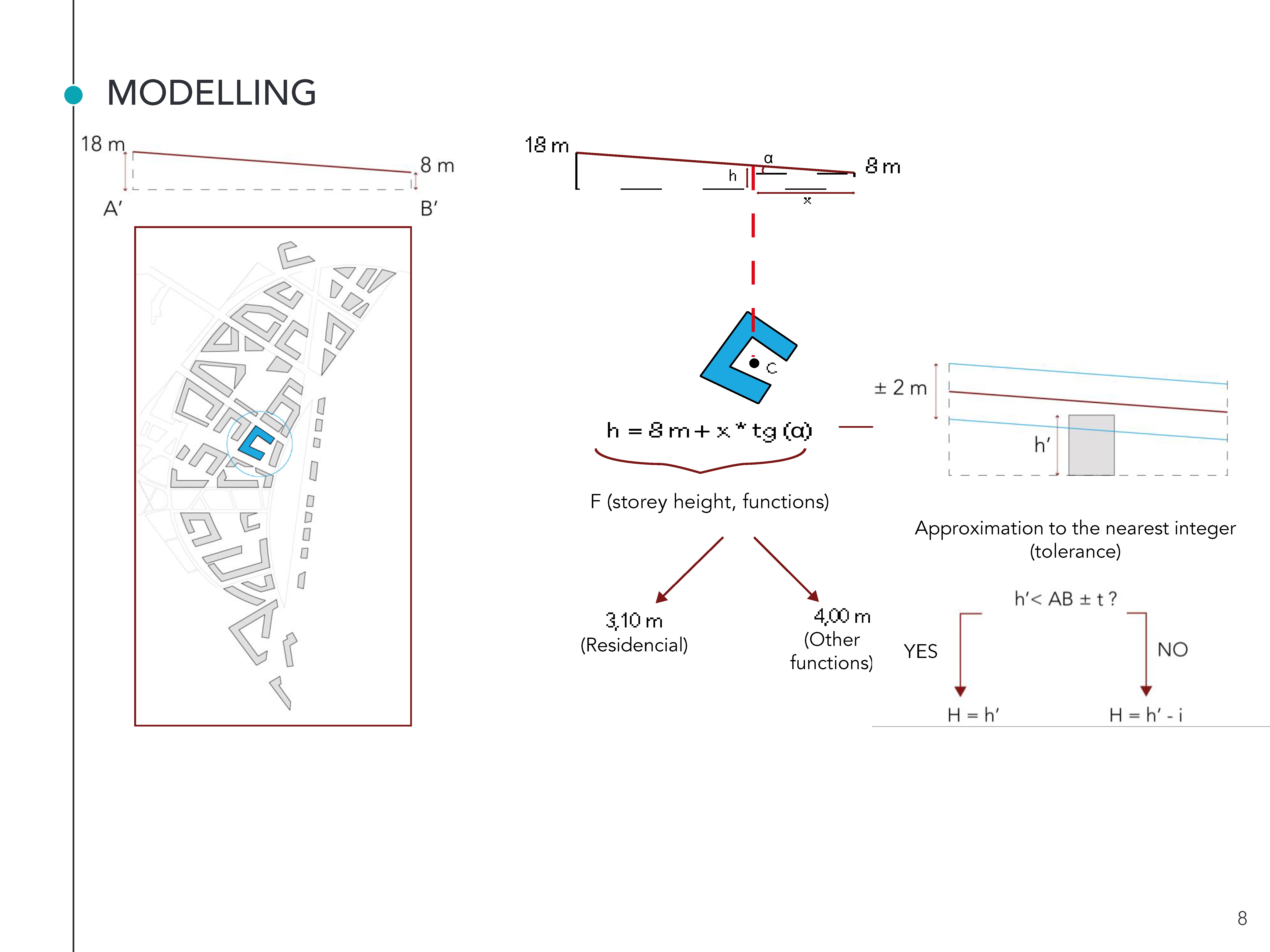
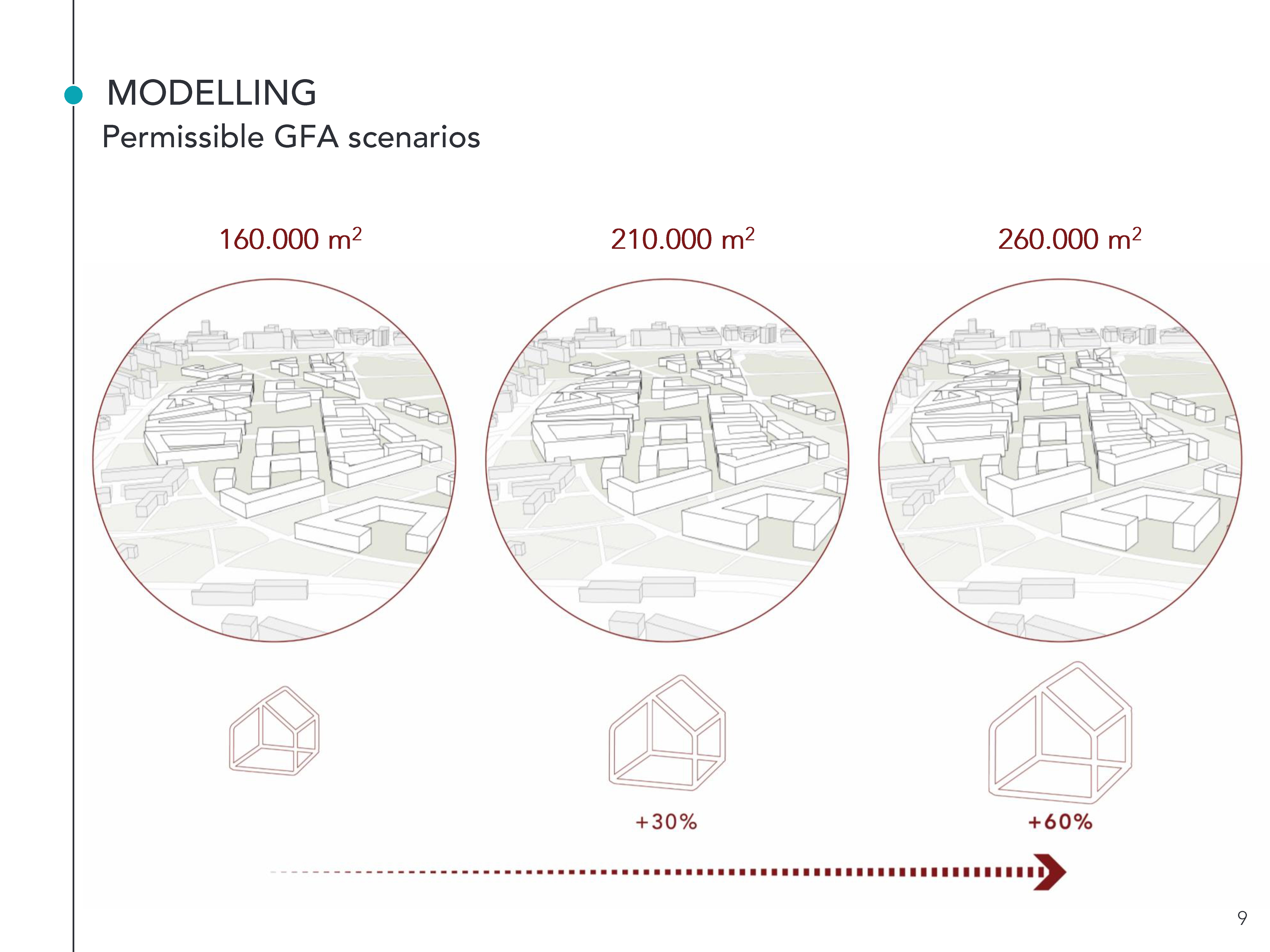
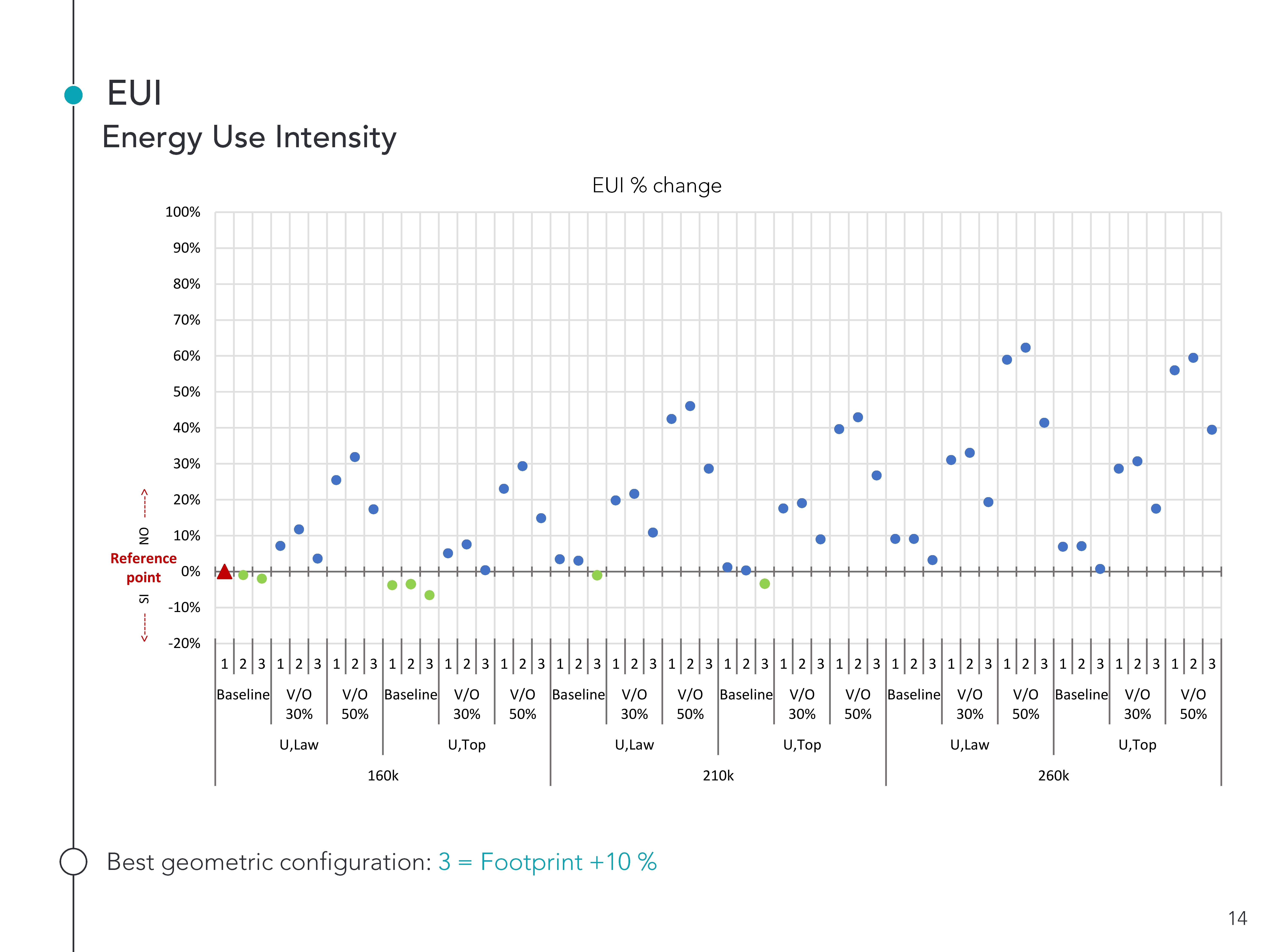
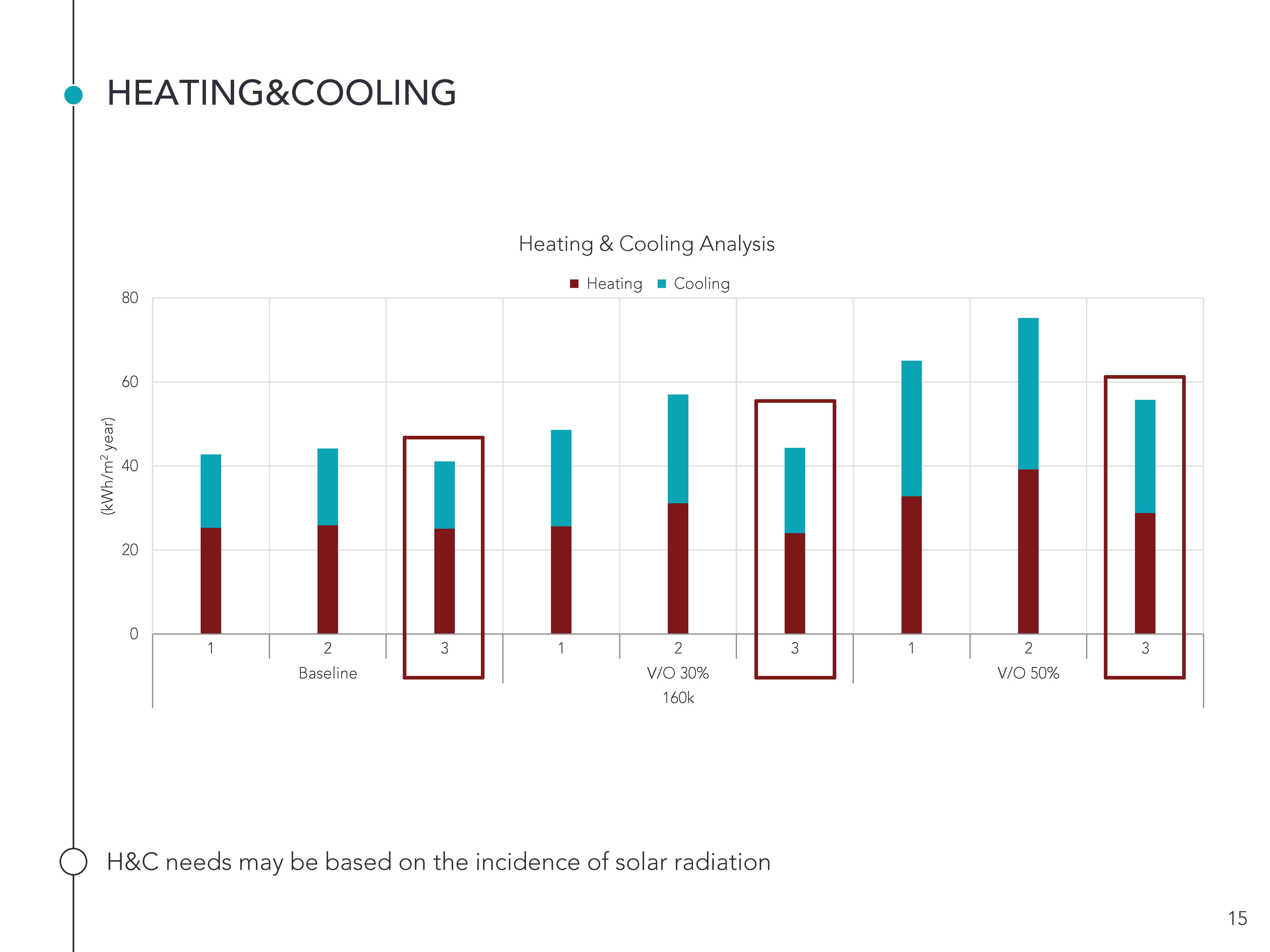
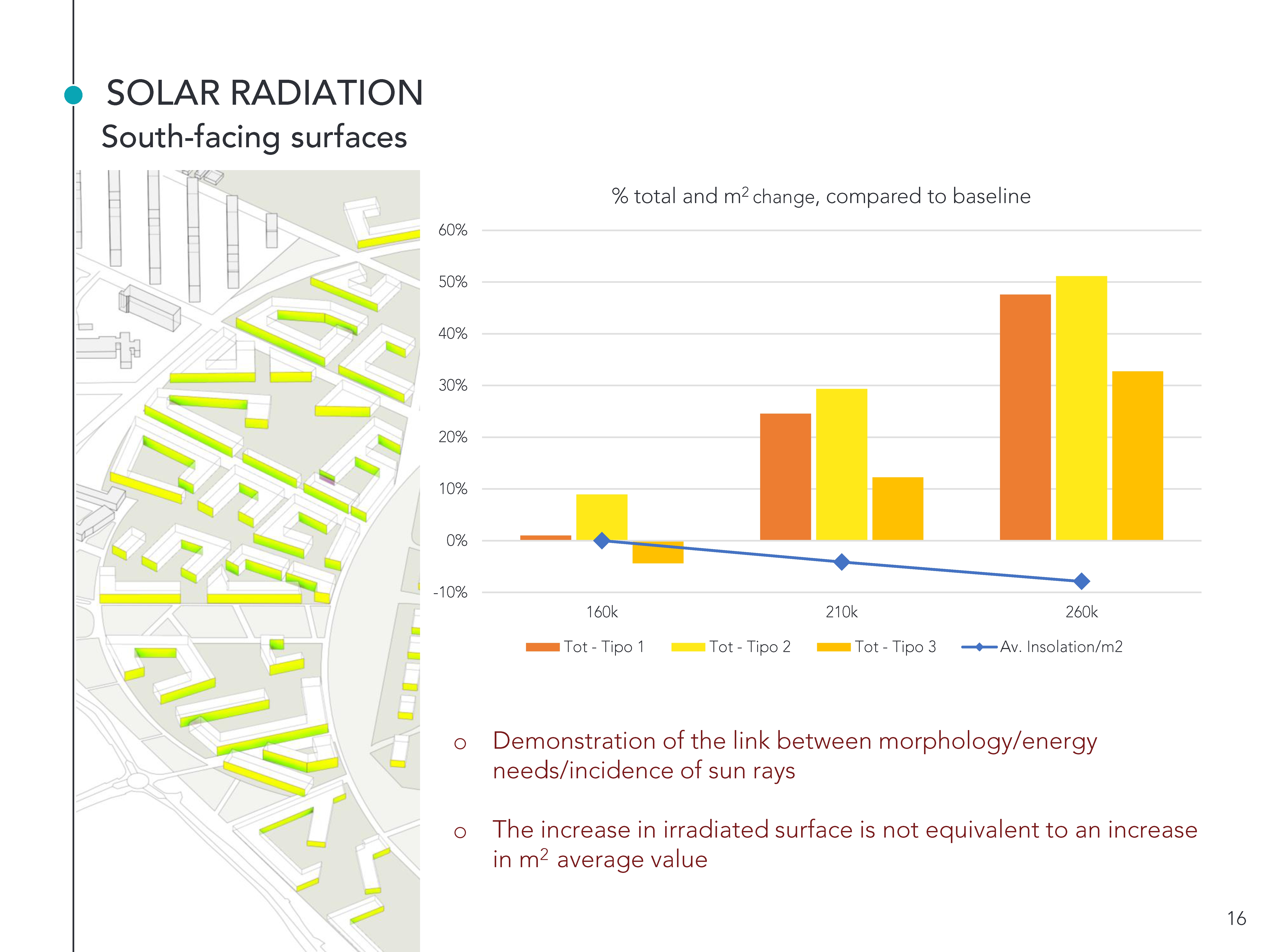
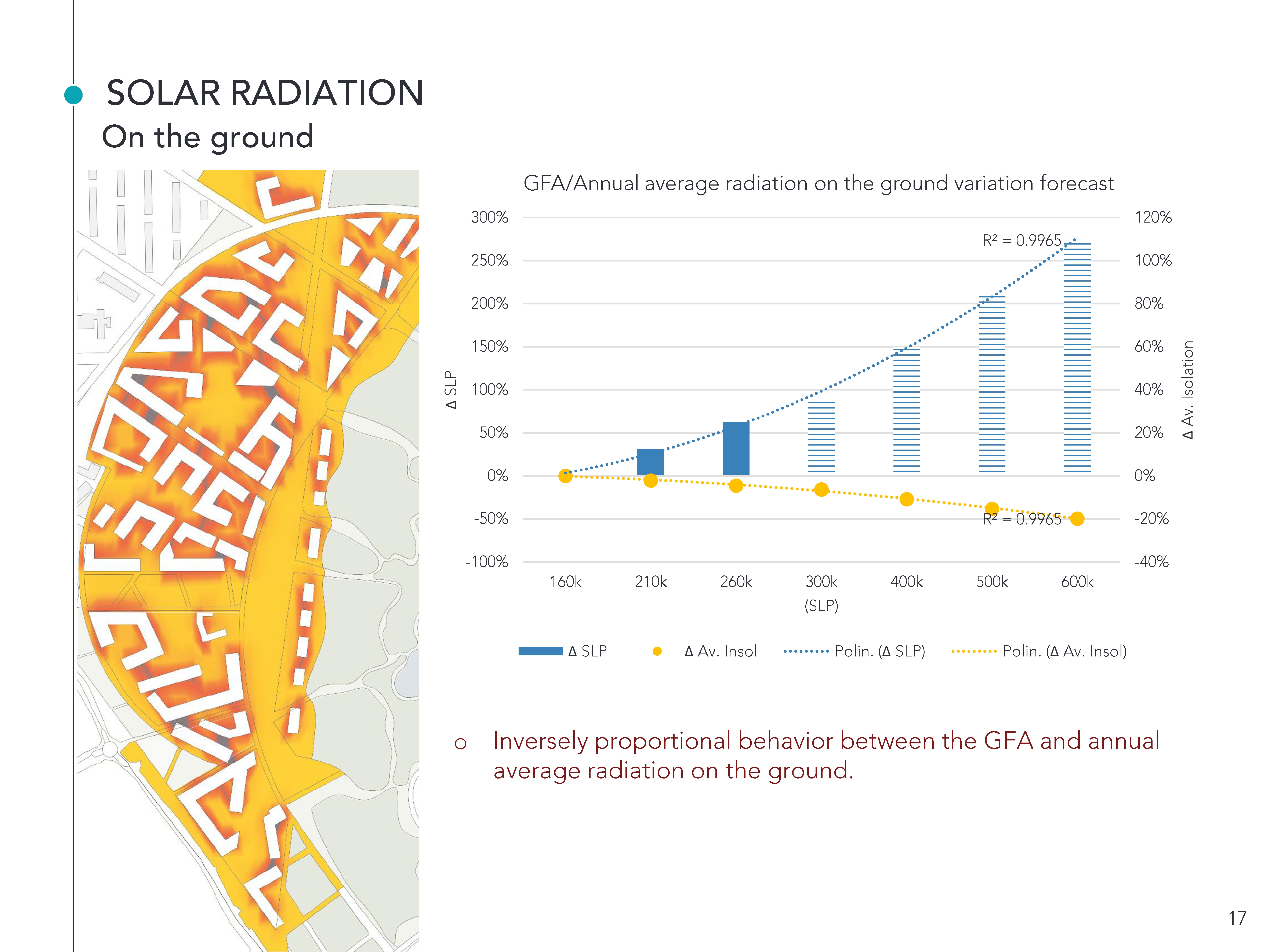
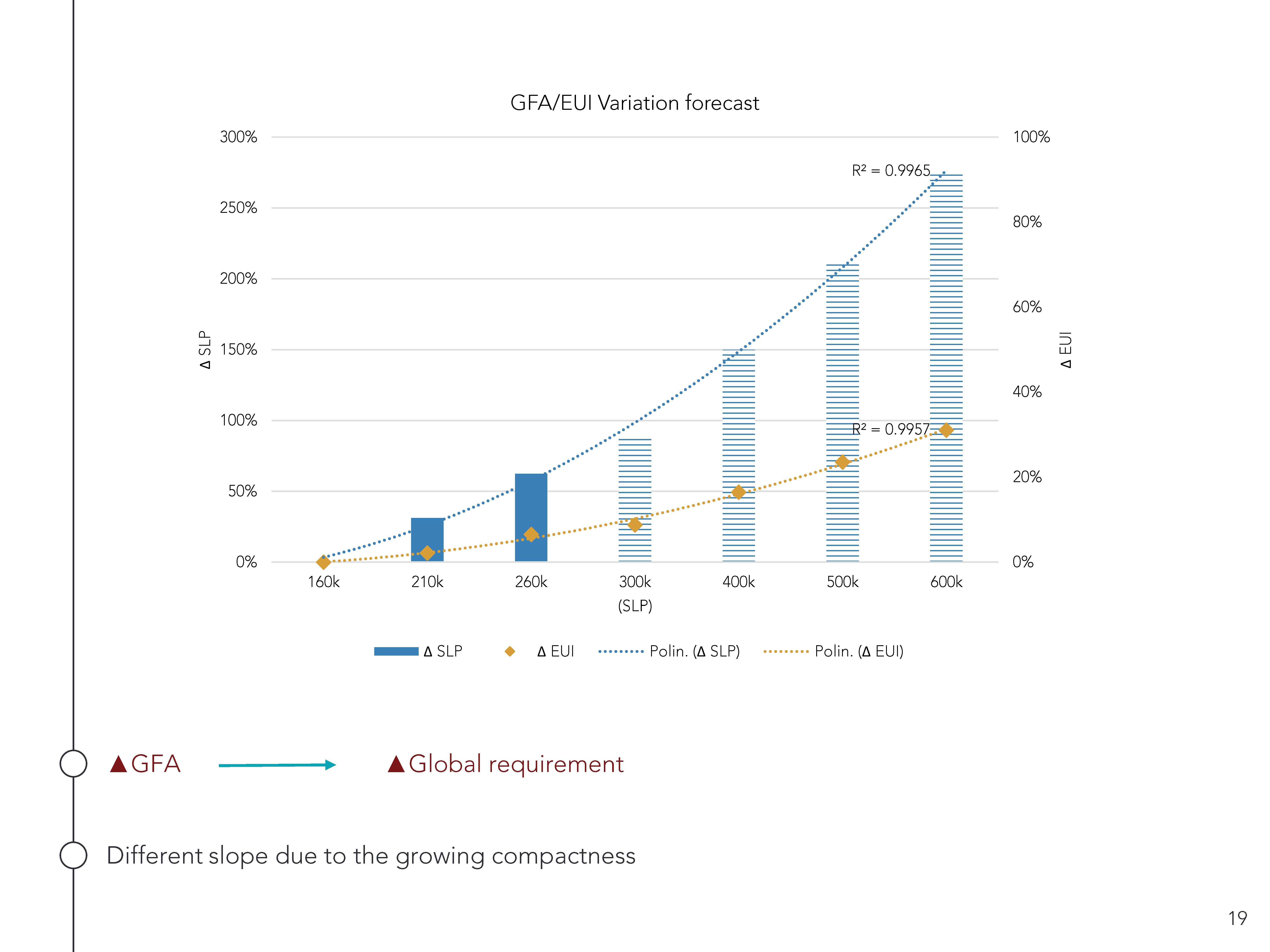
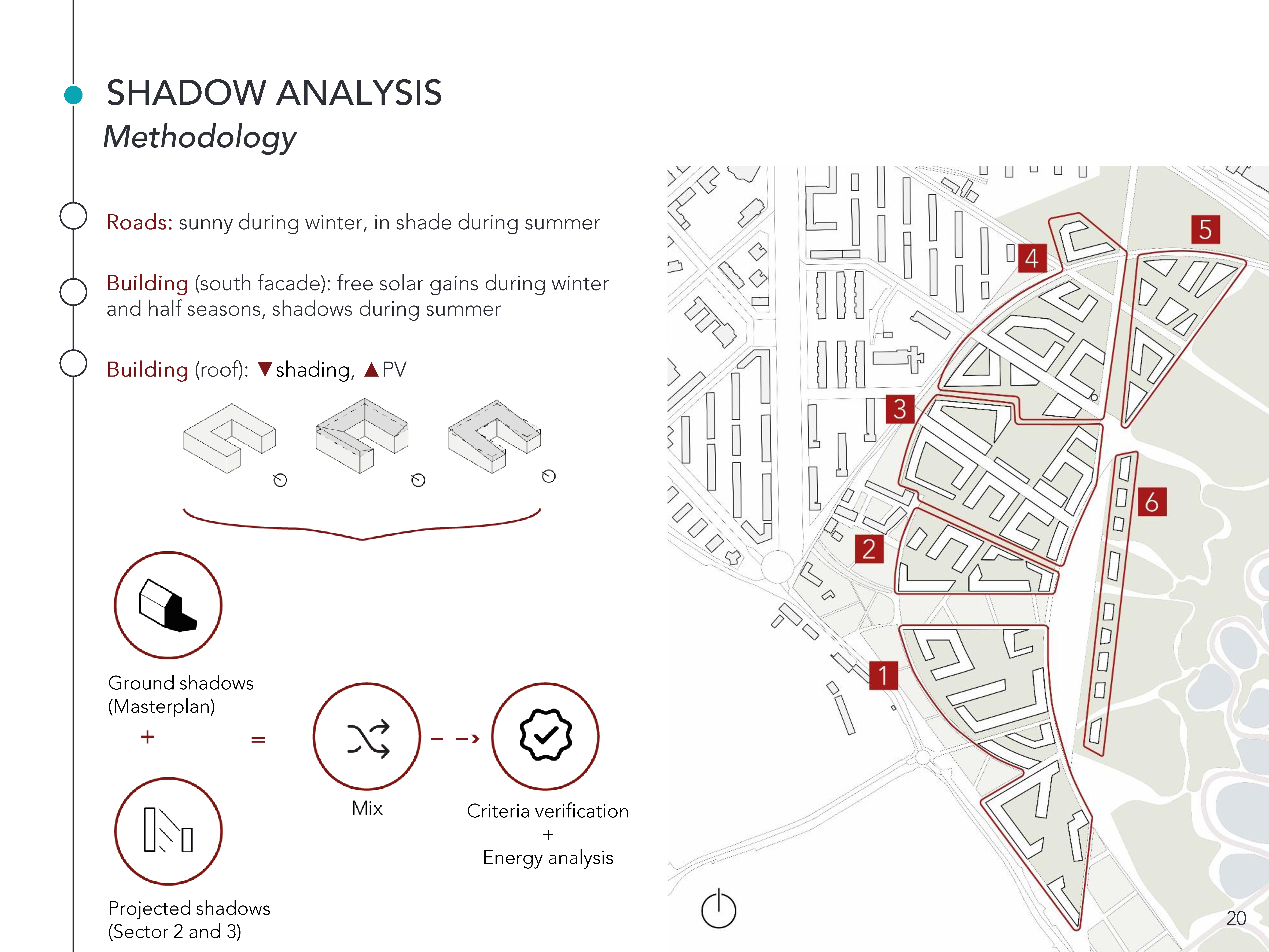
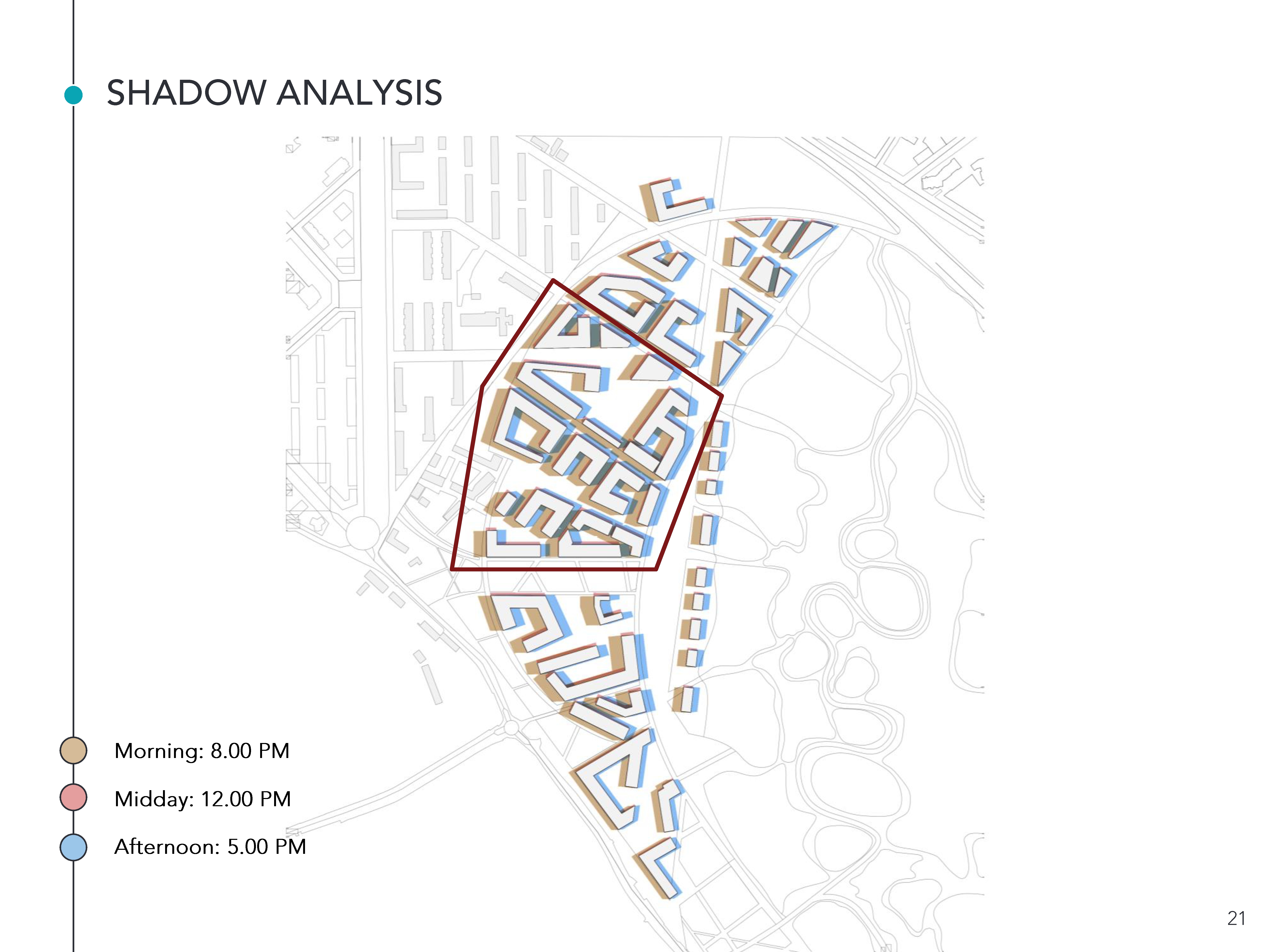
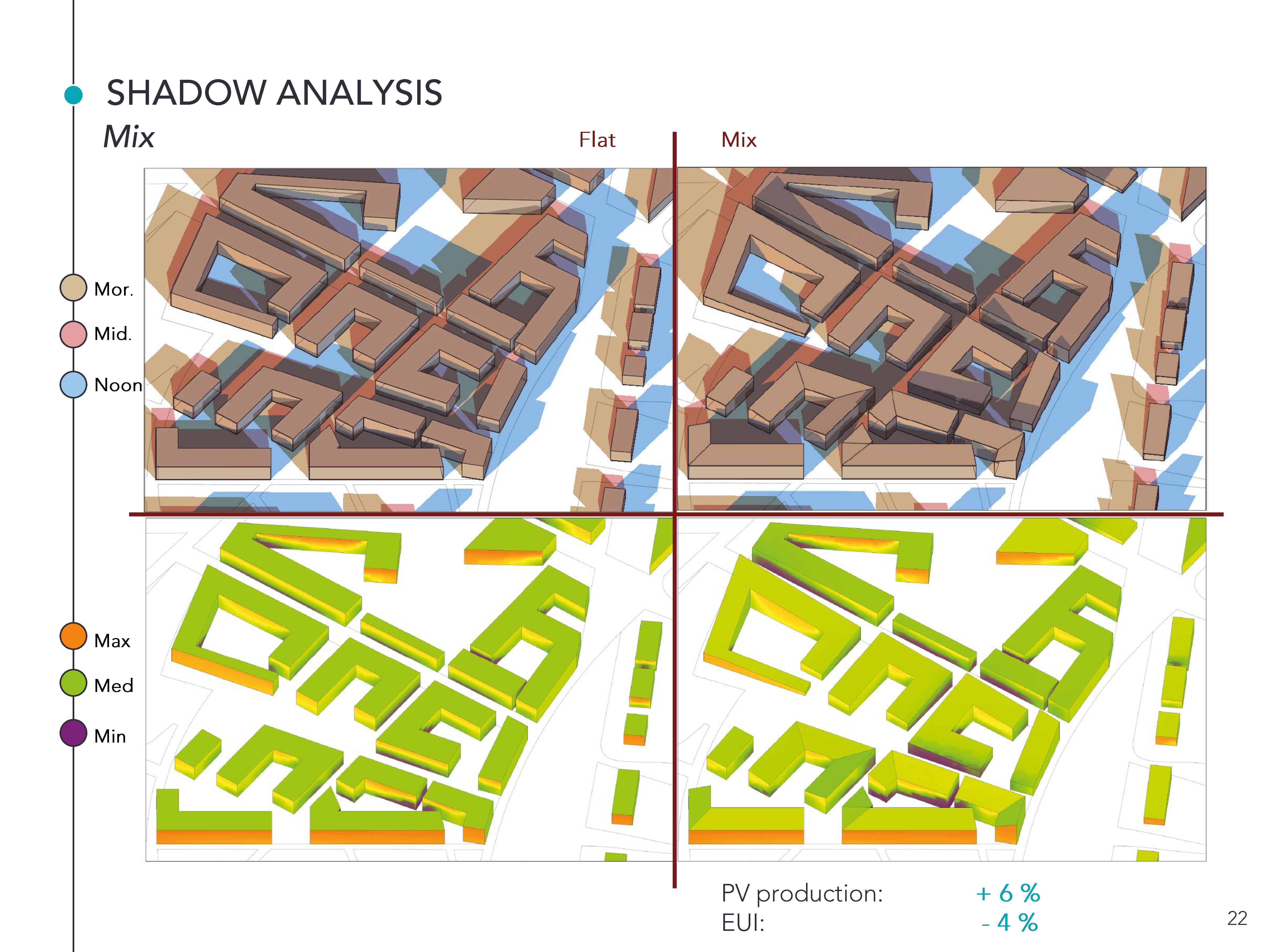
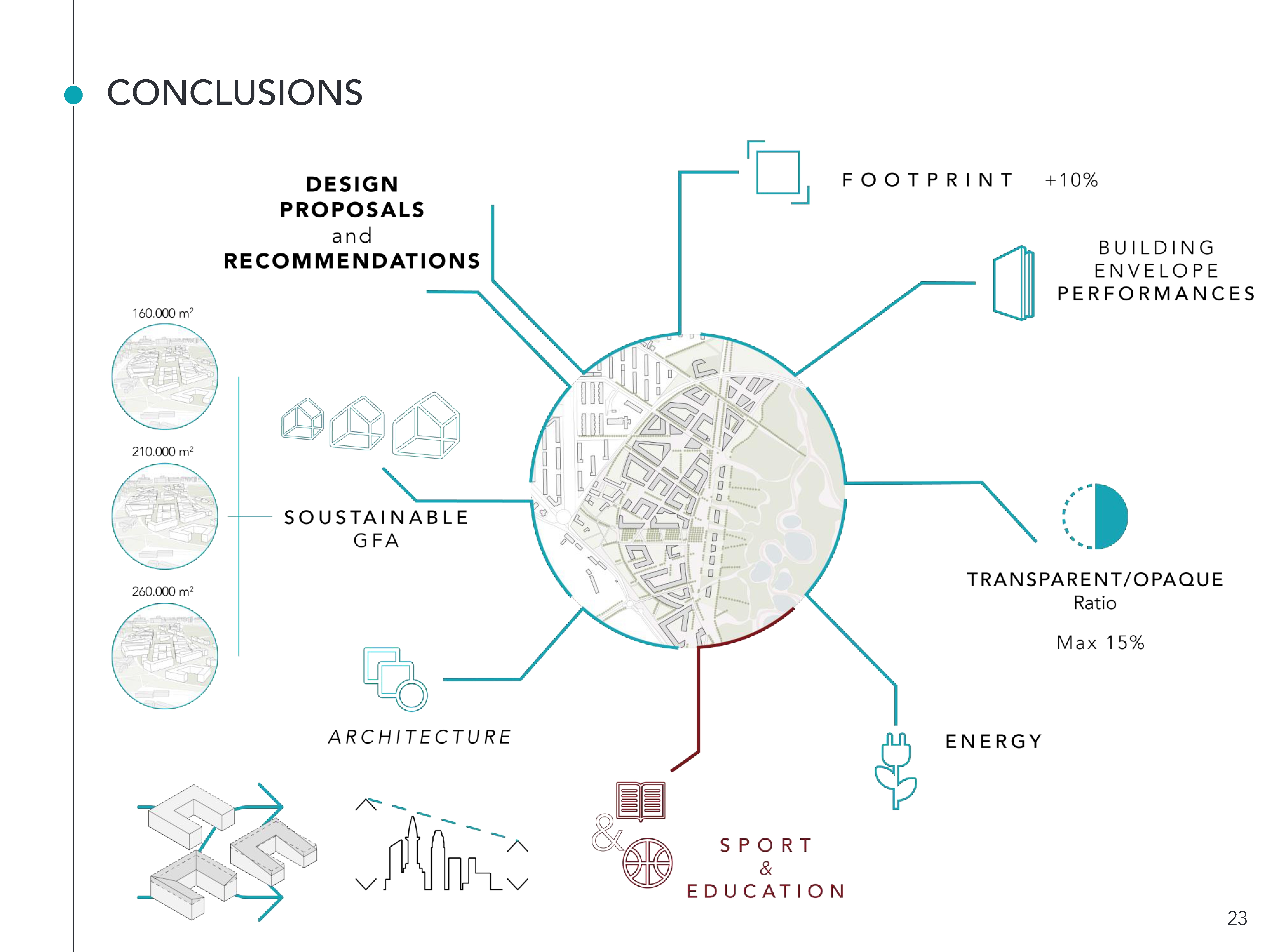
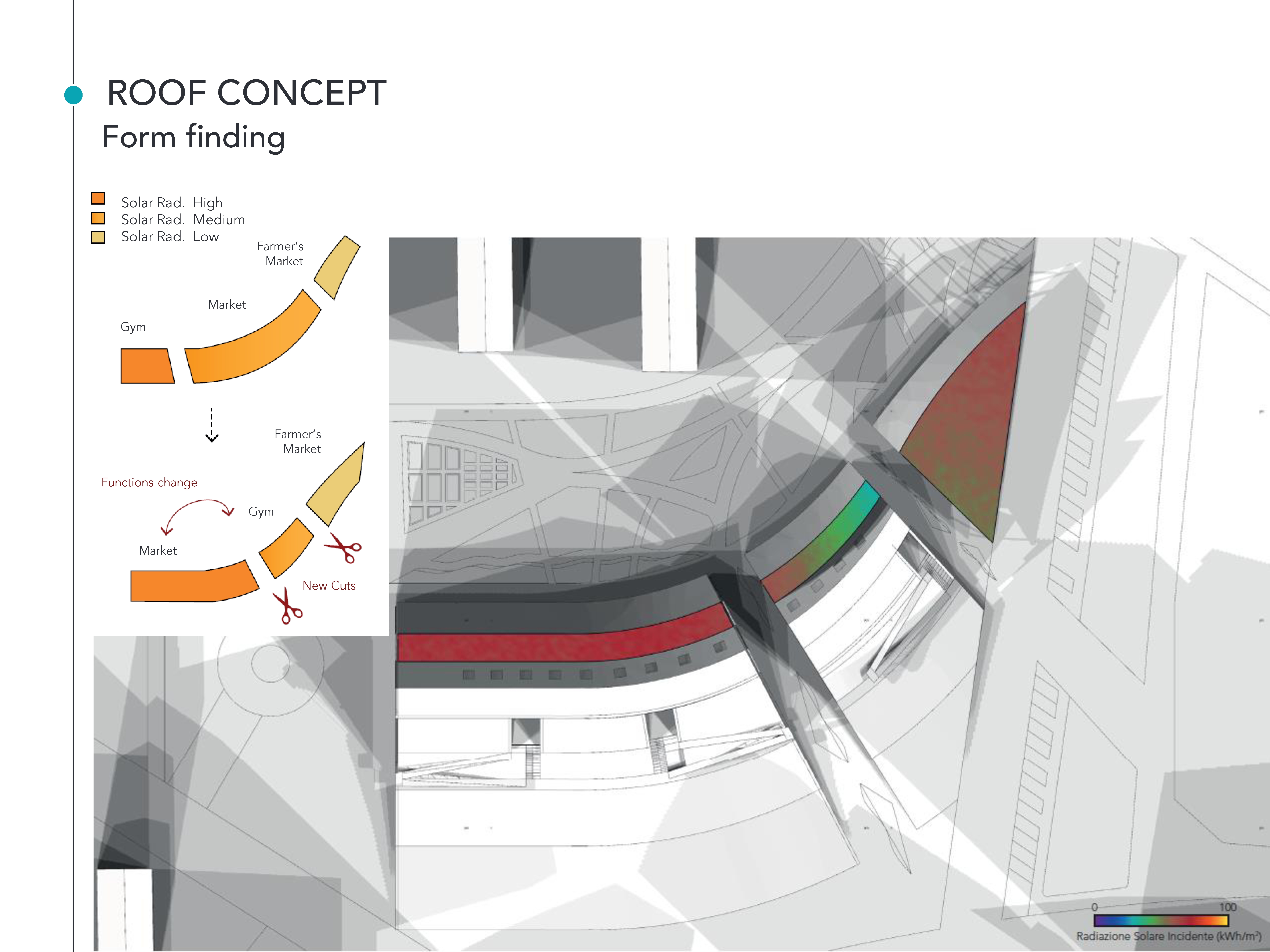
The masterplan has been developed through a parametrical application of IMM methodology. Conceived at Politecnico di Milano, IMM considers cities as Complex Adaptive Systems (CAS) consisting of different interacting subsystems: environmental, economic, social and cultural ones.In order to meet strict environmental requirements, the masterplan was submitted to a local optimization to assess the impact of smaller-scale design decisions to the overall design layout. The main performance indicators considered are Energy Use Intensity (EUI), solar radiation on south-oriented surfaces, potential production of renewable energy from roof-mounted photovoltaic panels and solar radiation on the ground.
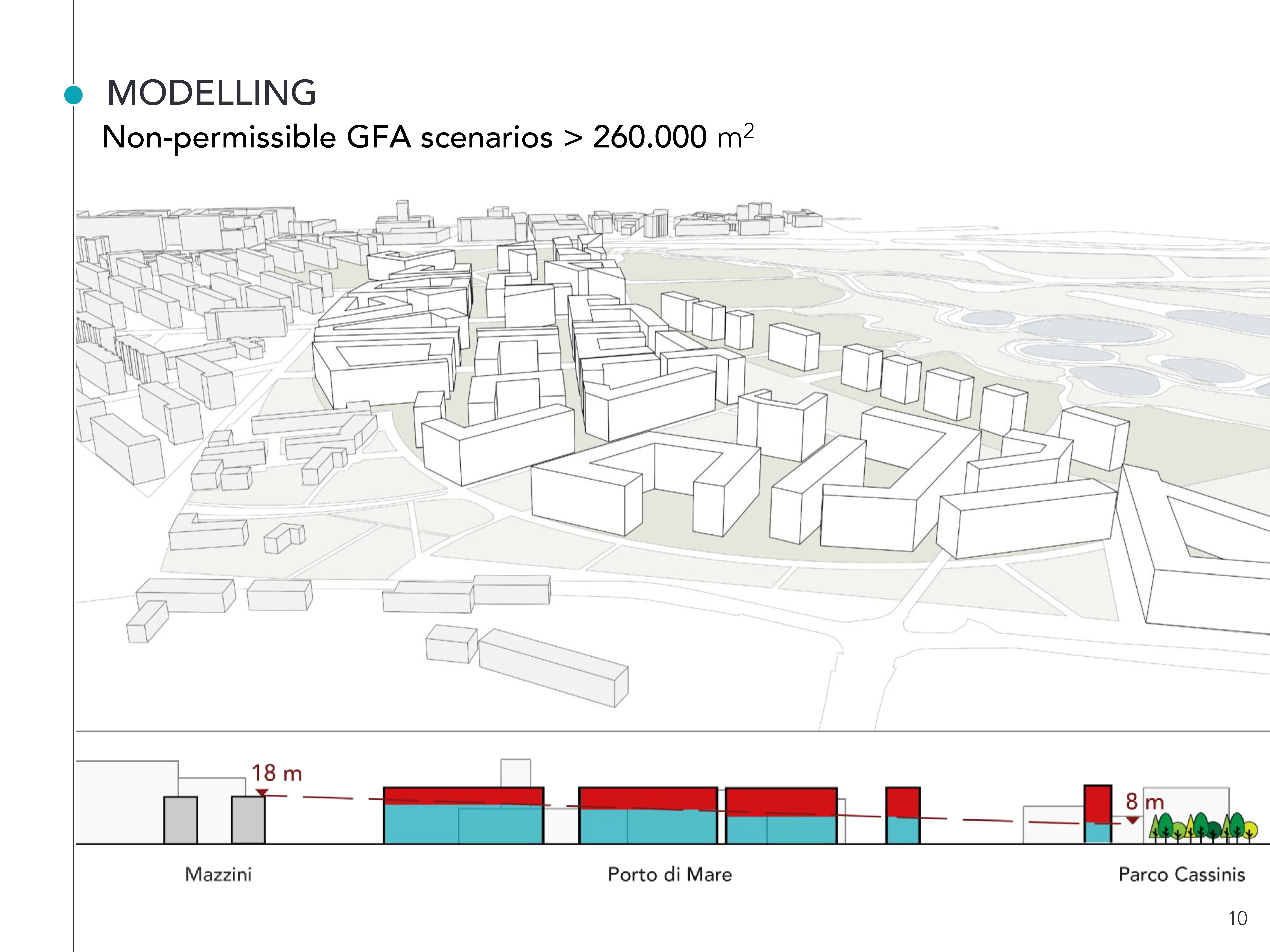
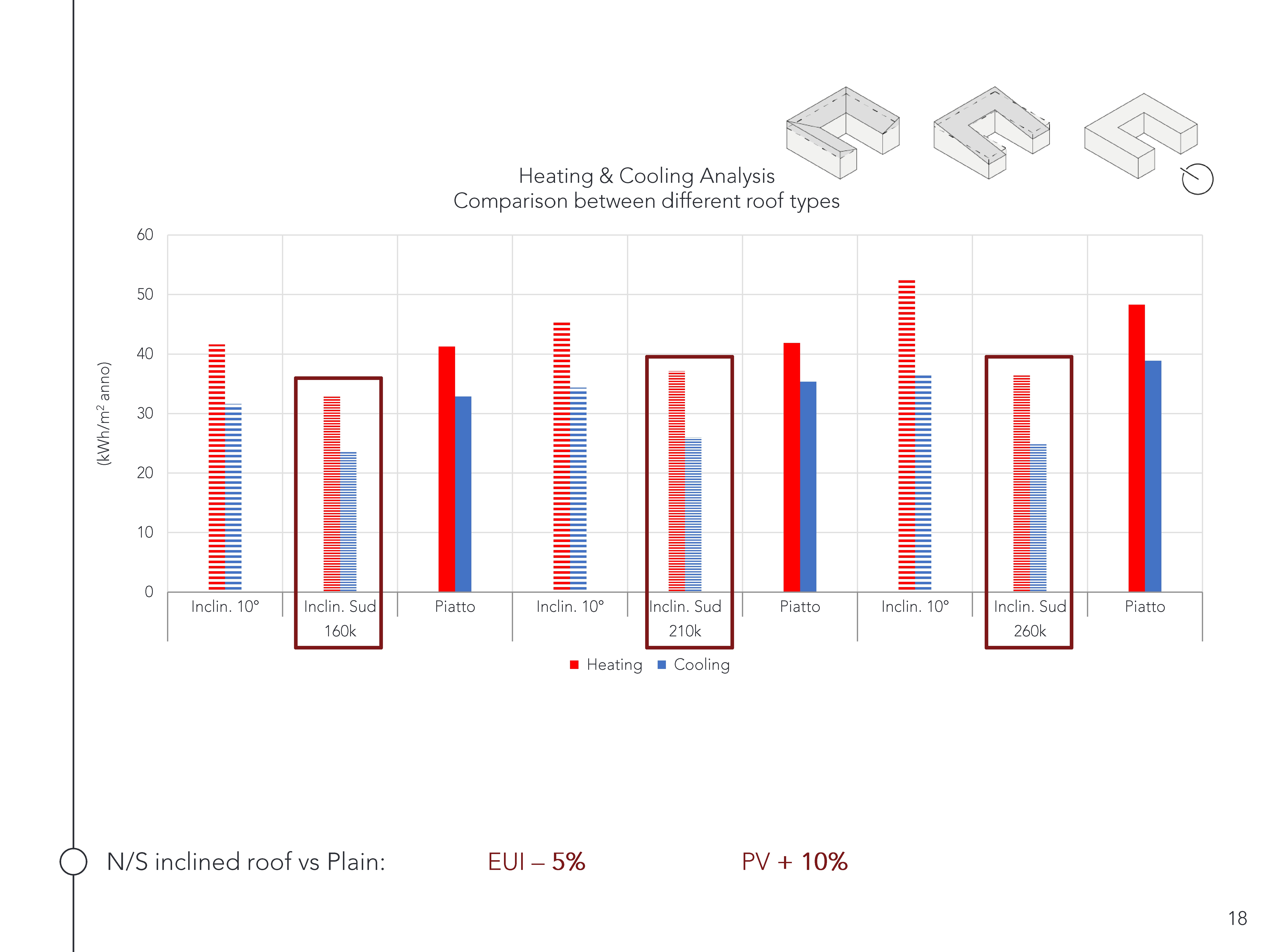
Through an iterative multi-stage and multi-layer process, based on the dynamic synergies between a proprietary BIM software and its visual programming plug-in, managed via an algorithm developed by the authors, energy analysis was performed since the early stage of design, using a combination of key factors such as building height, orientation and footprint, surface and volume ratio, shadings and PV panels, road dimensions, roof slope, average U value of the building envelope and window-to-wall ratio (WWR). As a result, 3 plausible low carbon Gross Floor Area (GFA) options have been identified in order to better match the Eco-District purposes and the institutional planning outlook.
Finally, a micro-optimization via the multi-layered modelling process has been applied at a smaller scale during the study of the Food District and Transportation Hub.The final goal was to identify a replicable approach for similar problems and contexts.
Please give information about the key objectives of your concept/idea in terms of aesthetics and quality of experience beyond functionality and how these would be met
Along with functionality and energy efficiency, it was essential to consider the necessity of a pleasingly aesthetic and comfortable environment for a district where many different cultures would establish and coexist. It was important for them to feel at home.
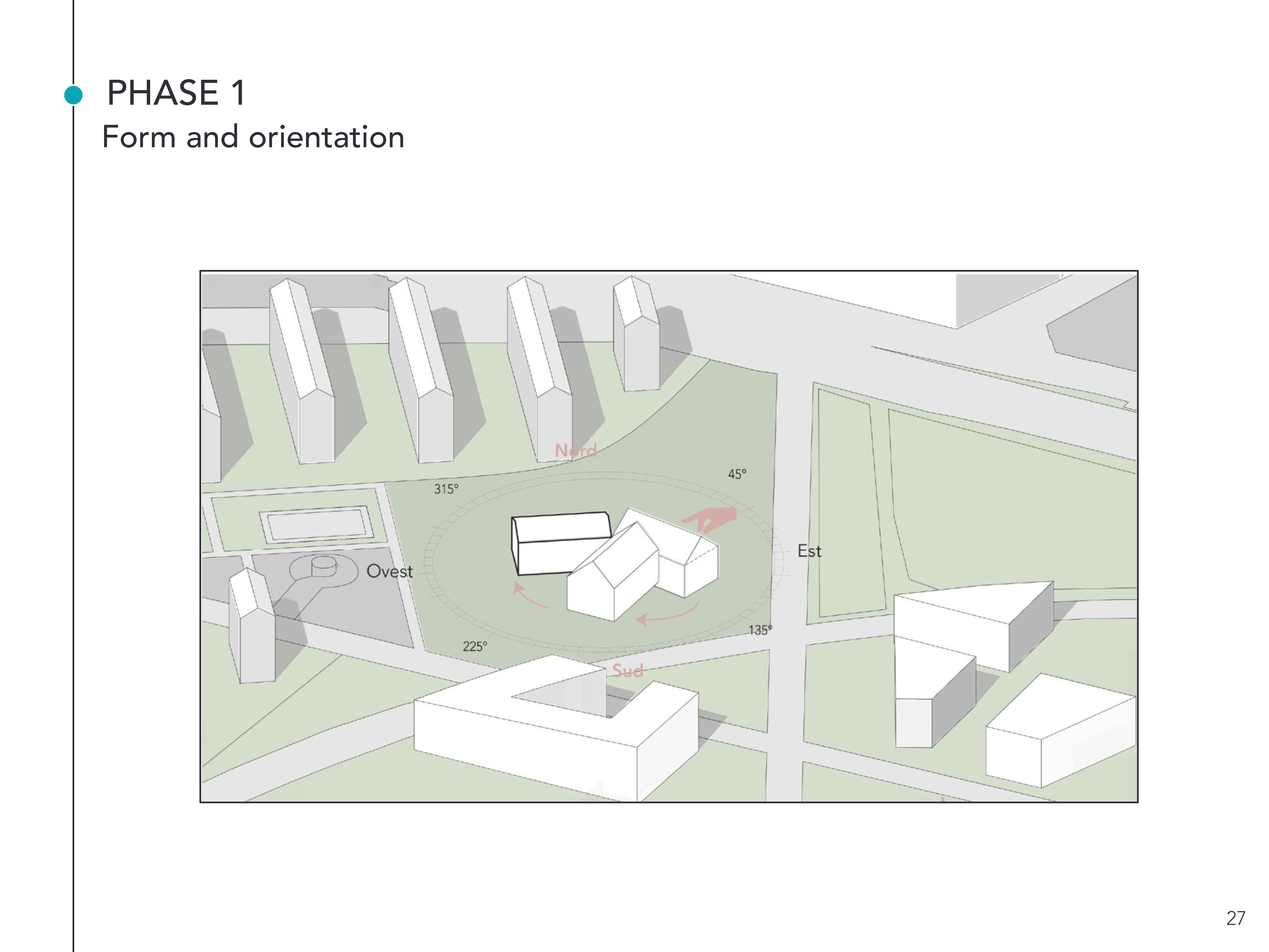
The masterplan was developed to give architectural consistency to all the hints and advice coming from the diagnostic activity. Porto di Mare is located on the south-eastern border of the city of Milan, bounded by important infrastructures, between the city center and the rural belt surrounding the Milanese metropolitan area. It was important therefore to maintain the sense of progression from countryside to metropolitan area, through a gradual increase of the buildings’ geometric characteristics: building heights would progressively increase from the countryside to the city; roads shouldn’t be neither too narrow nor too large and progressively increase in dimensions from the countryside to the city center; vegetation should be present in a good quantity.
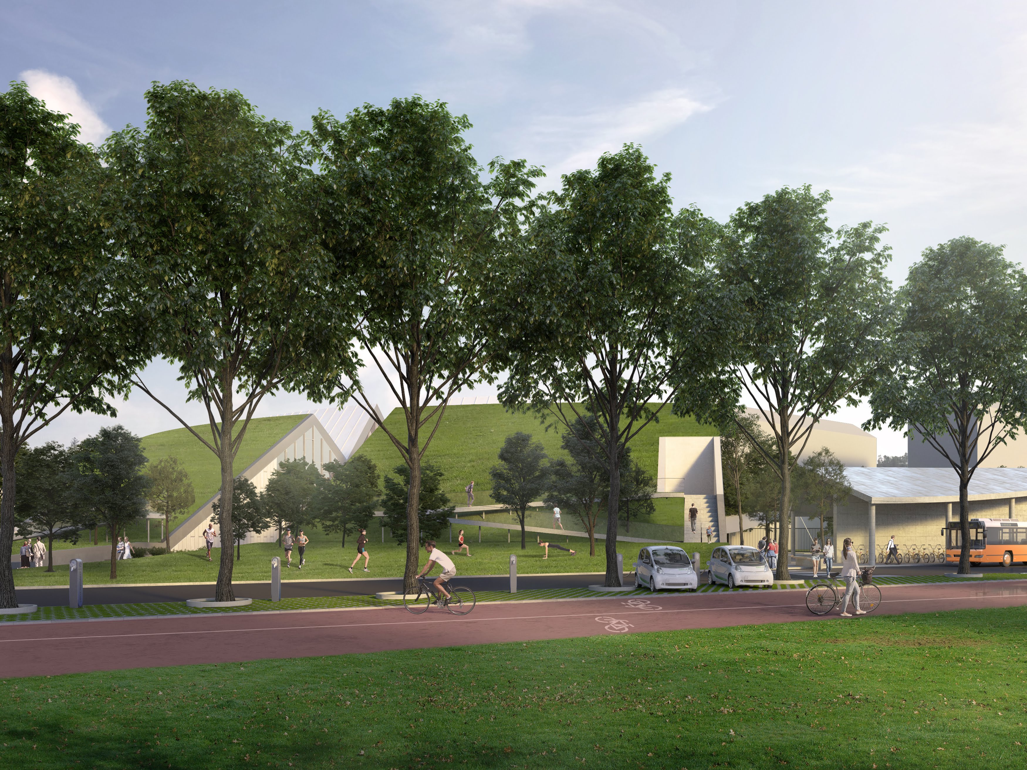
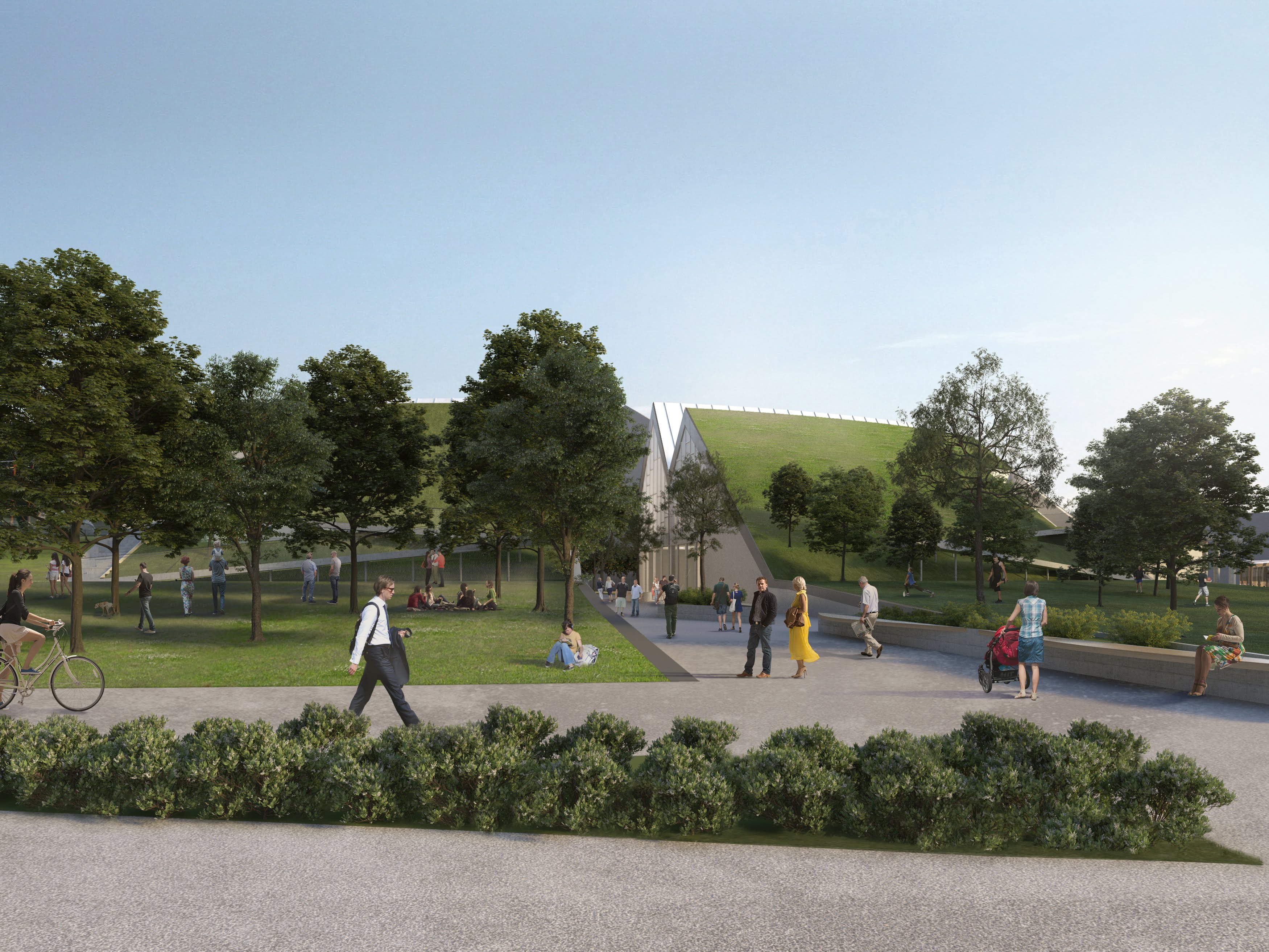
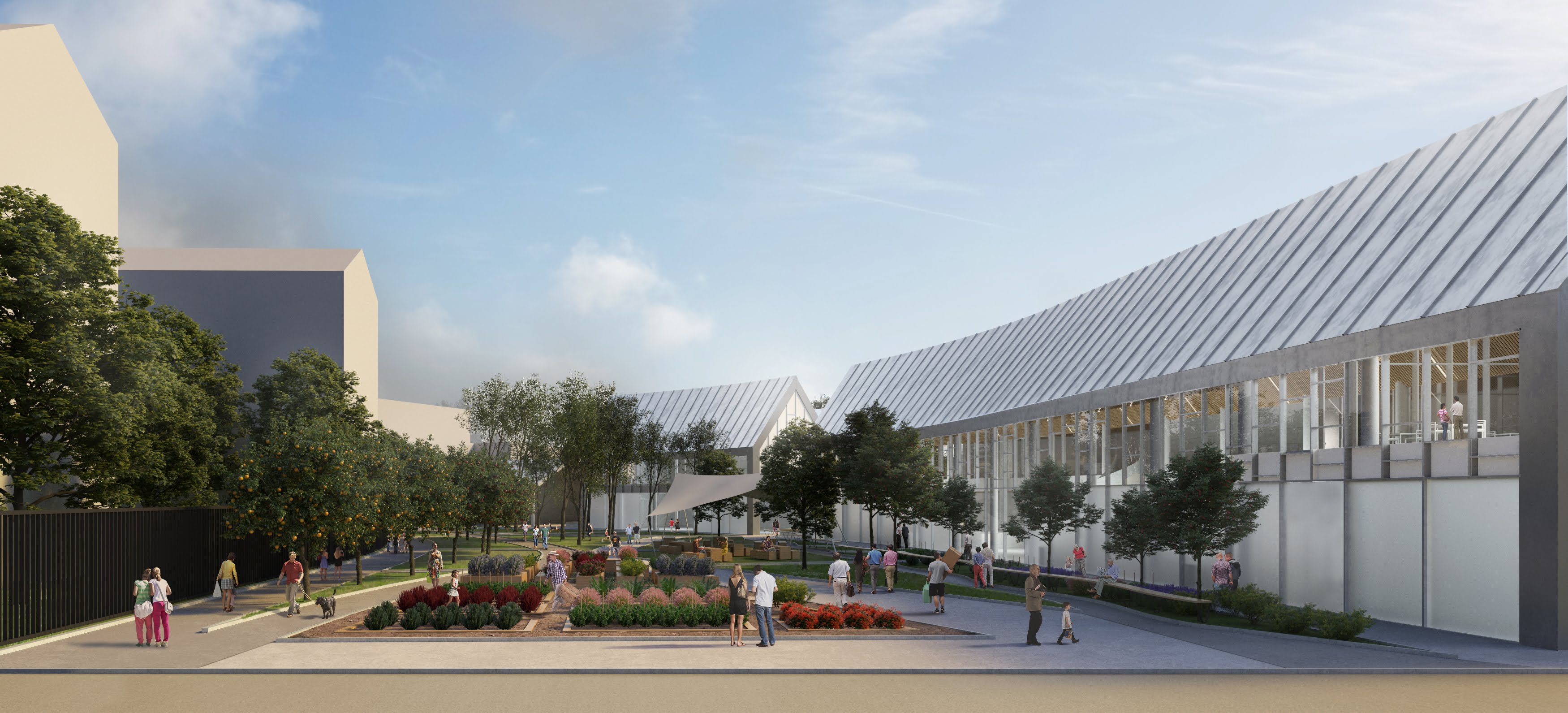
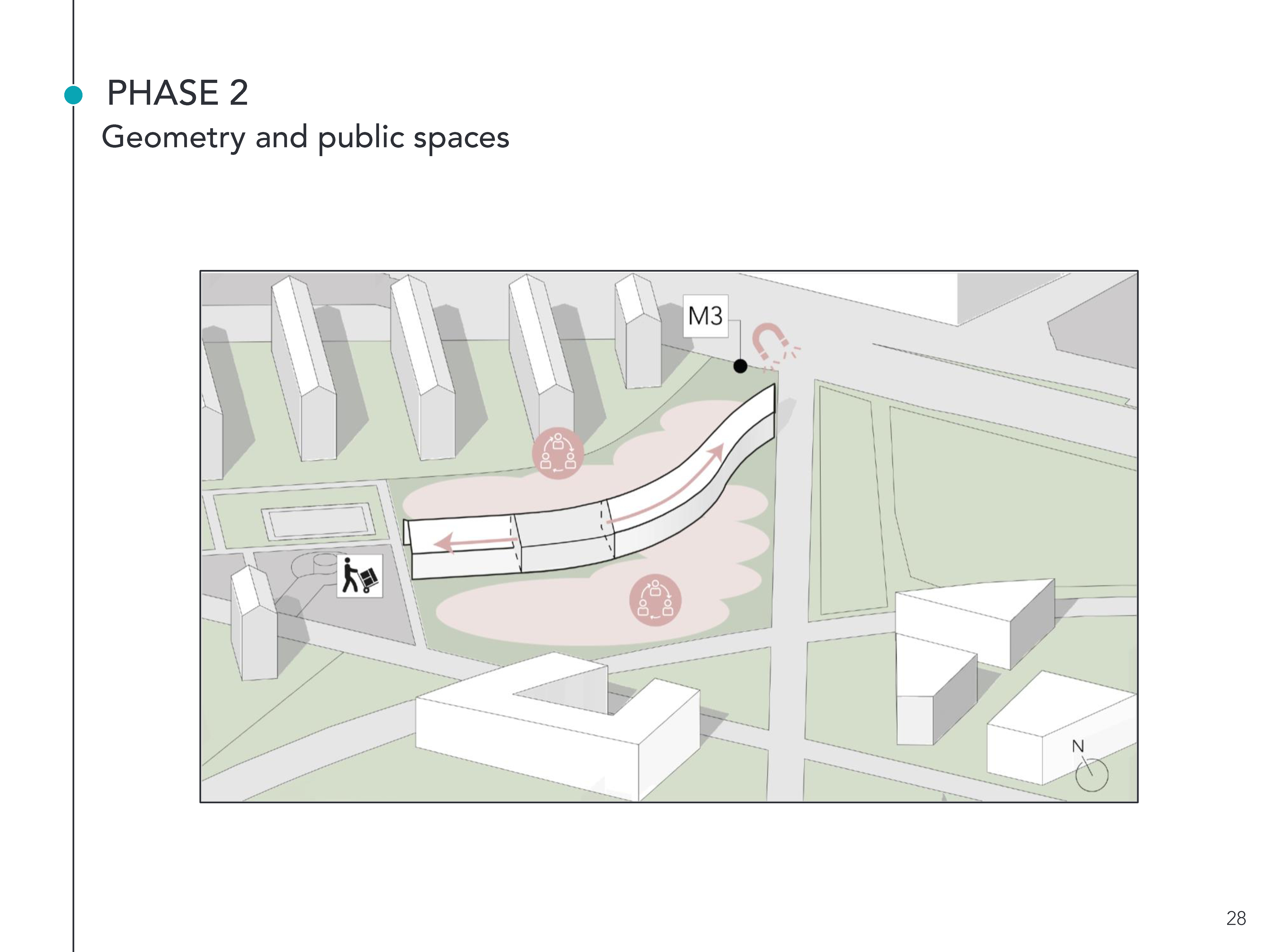
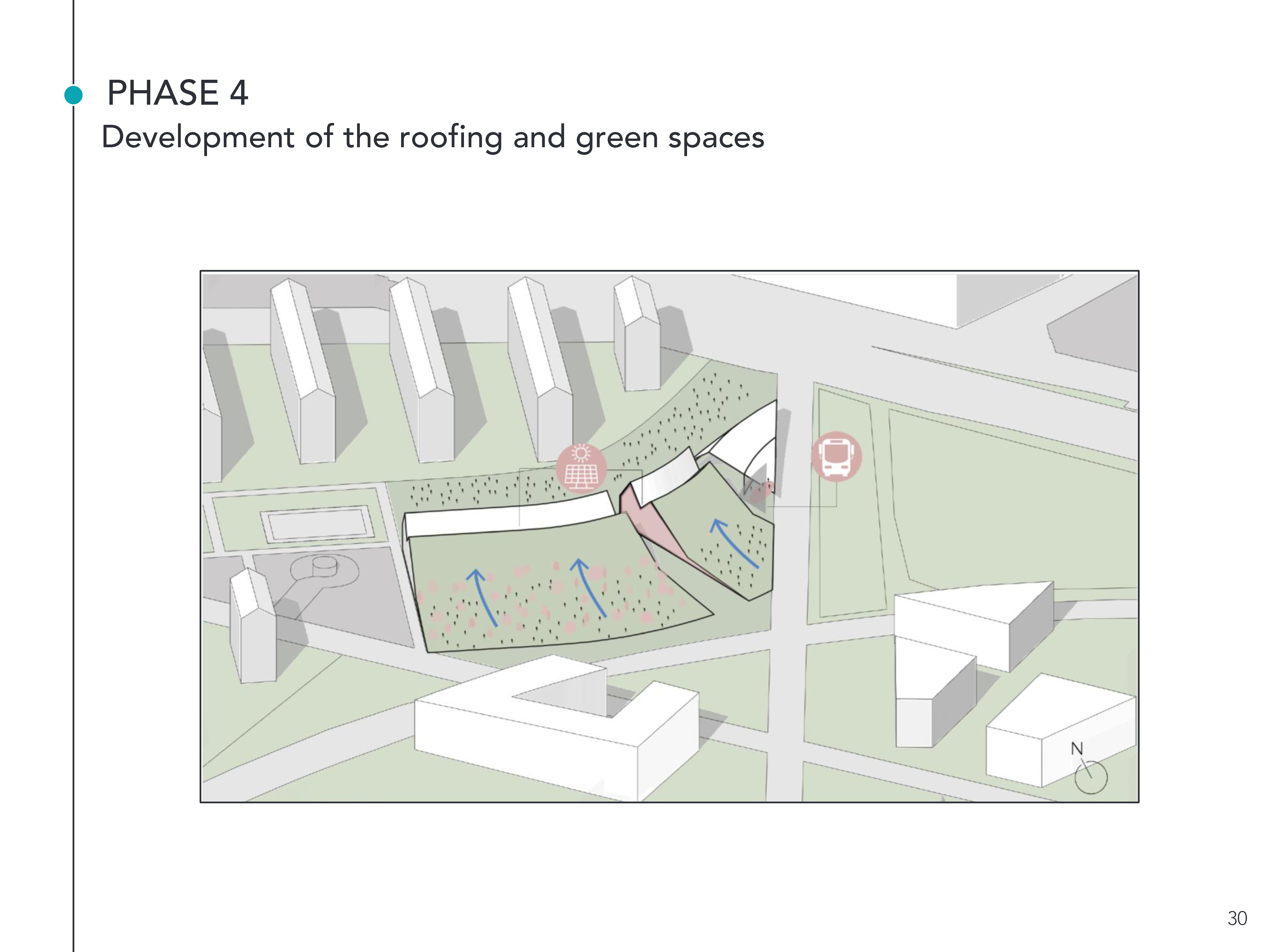
Furthermore, design principles were based on energy related aspects: roads should be sunny during winter and shaded during summer; south facades should be exposed to sun in winter and mid-seasons and shaded in summer; building heights, roof slopes and window-to-wall ratios should be taken into consideration. Finally, the Food District and Transportation Hub was thought as a place of encounter and exchange, where citizens are invited to enter and encounter different people. The green building slope seems as if the countryside has lifted to create a shelter, and the glass façade creates permeability between inside spaces and outside areas. The building’s orientation and height make it recognizable but not overwhelming, and from the green roof it is possible to see the countryside on one side and the urbanized city on the other.
Please give information about the key objectives of your concept/idea in terms of inclusion and how these would be been met
Inclusion was one of the strongest objectives of the project because of the current situation of the case study area.
Porto di Mare district is nowadays classified as an Urban Transformation Area (ATU 15, PGT Milan 2030) and it is included into the Europan 12 competition. Although the entire area was subject to important guidelines concerning the urban arrangement of Milan since the end of the 19th century, today it is characterized by physical and sociological degradation, abusive settlements and abandonment. However, this area presents a multi-ethnic society with the coexistence of different cultures and traditions potentially ready for a bottom-up approach acting on people and transforming users into more sensible agents.
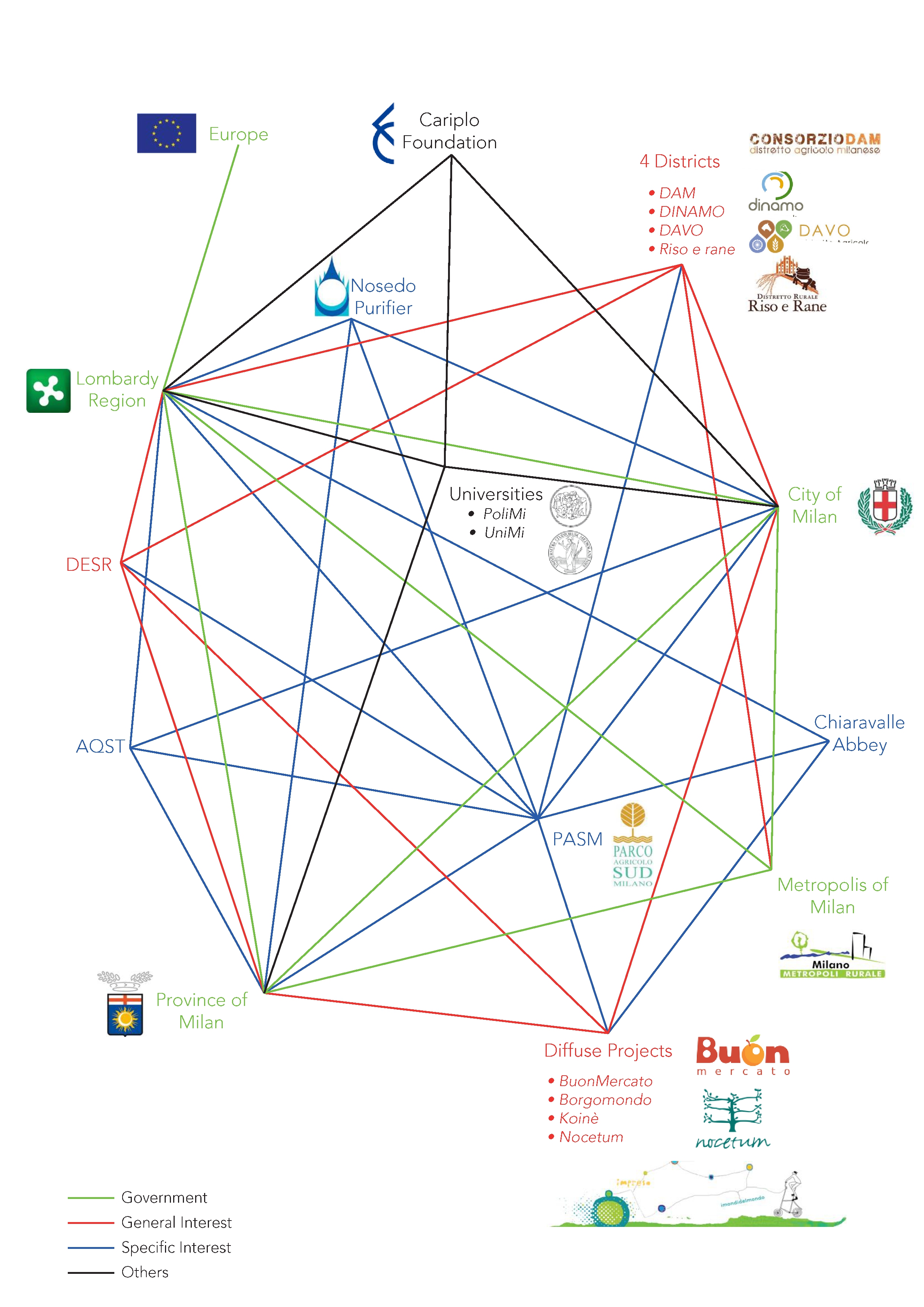
To achieve these goals, an integrated proposal for an Eco-District has been elaborated in accordance with both public and private partners (such as Milano Depur S.p.a. – Depuratore Milano Nosedo; REsilienceLAB; Gruppo Ecologisti Est Milano – GREEM; Wageningen University and Research – WUR and many others). The outcome is a masterplan that dialogues with the existing Mazzini neighborhood and promotes social and urban inclusion. The existing metro stop has been integrated into an interchange hub, encouraging soft mobility solutions for a car-free district. A natural green corridor traversing the public park Cassini connects the city to the countryside, permitting a new outdoor experience.
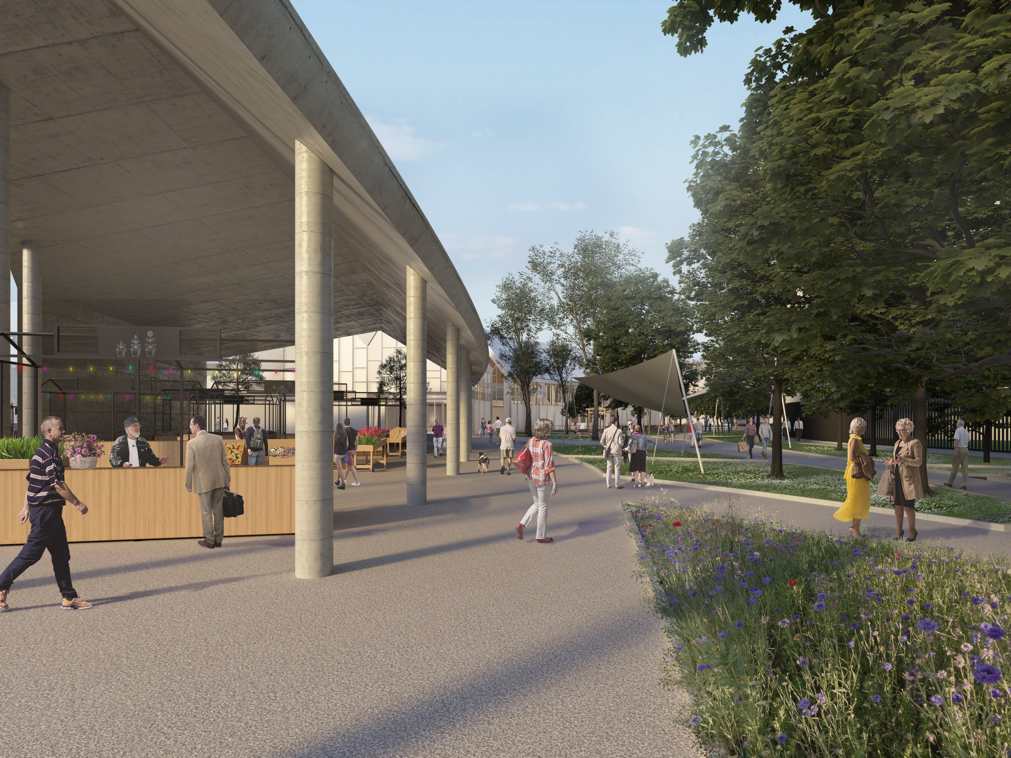
Moreover, the Food District and Transportation Hub are designed to gravitate toward the idea of the Market, historically a symbol of trades and exchanges. Furthermore, due to its strong connection with the rural system of the Southern Agricultural Park, the complex hopes to serve as an incubator, as well as a place where citizens may gather, serving as the joining link between old and new.
Please explain the innovative character of your concept/ idea
The innovative character is the multi-layered modelling approach used. Based on a dynamic control of design parameters through specific tools, it provides precious insights for the designers even while working on building masses at an intermediate design stage, showing a possible replicable approach for similar contexts.
The case study area is characterized by an unexpressed potential. A full integration of the infrastructural systems (mobility, building, green-blue infrastructure, physical flows of energy, water and waste) was investigated for a sustainable urban regeneration to design an eco-district, an intermediate scale capable of influencing actively the overall urban system.
Diagnostic activity of the area was carried out by Integrated Modification Methodology (IMM) application. It analyses the correlation between urban structure and environmental performance through a set of indicators aligned with the 17 UN Sustainable Development Goals (SDGs) for 2030. The results led to the eco-district masterplan developed engaging local stakeholders and defined through two international workshops in collaboration with the University of Cincinnati and the Wageningen University and Research.
The modelling strategy was applied to assess the impact of smaller-scale design decisions, regarding typological aspects, such as the roof shape, but also micro-modifications to the overall design layout and even technological choices. The definition of optimal Gross Floor Area (GFA) scenarios according with Milan Territorial Government Plan (PGT), the evaluation of environmental performances of the district and the comparison of alternative building layouts for a city-to-countryside urban transition were deeply investigated trough BIM parametric design tools.
Finally, outcomes are summarized in an integrated design of a Food district and Transportation Hub located in between the existing neighborhood and the new eco-district.
Please detail the plans you have for the further development, promotion and/or implementation of your concept/idea, with a particular attention to the initiatives to be taken before May 2022
A better investigation of social and economic aspects could ultimately provide a complete and effective tool for decision makers to evaluate the current level of urban system performance and the impacts of future transformations. In addition, new data sources such as sensors and citizen science data will be explored and integrated in the performance assessment to grant a more reliable and up-to-date picture of the behavior of the urban system. Social leverage will be driven by services, assistance, healthier lifestyles, solidarity and sharing.
Furthermore, the idea could tend towards the “Smart” or “zero cost” City concept by involving a multidisciplinary method and technological partners that collaborate in the design of the district integrating the property, digital, energy and social sectors with the aim of reducing buildings energy/maintenance costs and supplying new value-added services that ensure the overall improvement of quality of life, minimizing the community expenses.
The overall multi-layered strategy shows how a simplified volumetric masterplan could measure performance aspects related to urban dynamics and the interaction with the surroundings, whereas energy aspects benefit from a finer grain investigation. Parametric design tools were not only used for form-finding, but rather for adjusting a given layout based on minor typological building modifications (height, floor plan depth, roof, WWR) becoming a resource for the Project Management development approach.
Porto di Mare area has recently become property of the municipality. Therefore, the real estate pre-development process could be more agile especially in terms of local jurisdiction authorizations and land use license thanks to a possible active role of the p.a. with the general contractor and project manager. Finally, agreements with industrial/financial partners will be made to finance execution planning, construction and operation.
III. UPLOAD PICTURES


IV. VALIDATION
By ticking this box, you declare that all the information provided in this form is factually correct, that the proposed concept/idea has not been proposed for the New European Bauhaus Rising Stars Awards more than once in the same category.
Yes